Economy
For People Worried About Climate Change, This Is the Best Place to Live in America
Published:
The effect that the environment has on the places people live in America has been in stark relief this month. Hurricanes have raked the coasts of Louisiana and Texas, bringing tremendous and destructive floods. Wildfires have devastated millions of acres, mostly in California and Oregon. The consensus among almost all climate scientists is that these situations will get much worse. Most identify five changes, the effects of which will spread across the United States and make life increasingly unlivable, or at least extremely uncomfortable. One tiny corner of America almost certainly will not be affected, and almost no one lives there.
A New York Times map shows what to expect, based on data from Four Twenty Seven, a firm that measures climate risk for financial firms. This map includes every county in the country. The negative climate effects on the U.S. population are divided into five areas: extreme heat, extreme rainfall, hurricanes, wildfires and water stress. Water stress is primarily the likelihood of drought. The risk that any of these situations become worse is forecast by county from this year until 2040.
No part of the country has a zero chance of being hurt by any of the measures. Nik Steinberg, the managing director of research at Four Twenty Seven told the Times, “Every single county has some sort of climate threat that’s either emerged and is doing some damage right now or is going to emerge.” However, a few counties have almost no risk of the effects of any of the five threats.
The map shows what most people would expect. Hurricane risk is greatest along the coasts of Gulf states, Florida and up the eastern seaboard. Wildfire risk is primarily in California, Oregon and Arizona. Water stress is mostly across the west, which was plagued by the worst drought conditions in centuries between 2011 and 2014. Extreme heat risk is highest in the area around Missouri, southern Illinois and parts of Nebraska and Arkansas. Extreme rainfall risks are highest in the upper Ohio Valley, which is across Ohio, West Virginia and Kentucky.
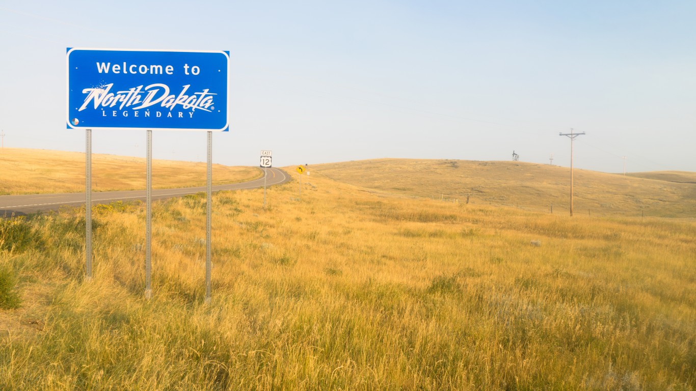
Risks are measured as very high, high, moderate, low and no risk. The only counties where there is either no risk or low risk of the five environmental factors are on the South and North Dakota border, plus one more in northern North Dakota.
The list includes Williams, Kidder, Logan, Emmons and Sioux Counties in North Dakota, as well as McPherson County, South Dakota. Each has no risk of hurricanes or the rise in sea levels that comes with them. Each ranks low for water stress, heat stress, extreme rainfall or wildfire risk.
Almost no one lives in these counties. Williams County has a population of 22,398 (though it was the second-fastest growing county in America between 2010 and 2019, according to the U.S. Census Bureau). Kidder County’s is only 2,435, while in Emmons County it is 3,550 and in Sioux County it is 4,153. Logan County has a population of 1,990. McPherson County’s population is 2,459.
The counties also share something else. They are geographically large, so their population density is among the lowest in the country. That leaves plenty of space for people who may want to relocate to one of the few places there is almost no risk of climate-related problems. At least until 2040.
After two decades of reviewing financial products I haven’t seen anything like this. Credit card companies are at war, handing out free rewards and benefits to win the best customers.
A good cash back card can be worth thousands of dollars a year in free money, not to mention other perks like travel, insurance, and access to fancy lounges.
Our top pick today pays up to 5% cash back, a $200 bonus on top, and $0 annual fee. Click here to apply before they stop offering rewards this generous.
Flywheel Publishing has partnered with CardRatings for our coverage of credit card products. Flywheel Publishing and CardRatings may receive a commission from card issuers.
Thank you for reading! Have some feedback for us?
Contact the 24/7 Wall St. editorial team.


Our expert who first called NVIDIA in 2009 is predicting 2025 will see a historic AI breakthrough.
You can follow him investing $500,000 of his own money on our top AI stocks for free.