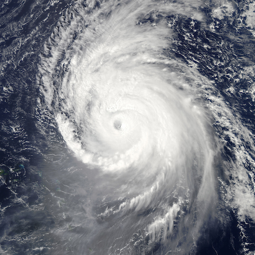
The average number of named storms in the years since 1981 is 12, of which six storms form into hurricanes, and three of the hurricanes reach intensities of Category 3 or higher. The forecast for this year is heavily influenced by the formation of an El Niño weather pattern in the southern Pacific Ocean.
Tropical storm activity has been above normal in 12 of the past 20 years, according to NOAA but the El Niño and cooler temperatures in the Atlantic are expected to lower the high-activity pattern.
El Niño causes stronger wind shear, reducing the number and intensity of tropical storms and hurricanes. During an El Niño, the wind patterns are aligned so that vertical wind shear is increased over the Caribbean and the Atlantic. The increased wind shear helps prevent tropical weather disturbances from developing into hurricanes.
The El Niño weather pattern can also strengthen the trade winds and increase atmospheric stability across the tropical Atlantic, which makes it more difficult for storms of the coast of Africa to intensify into tropical storms.
Extreme weather researchers at Colorado State University have issued a hurricane forecast that also cites below-average probability for major hurricanes making landfall all the U.S. coasts and in the Caribbean. The researchers are forecasting nine named stores, of which three will intensify into hurricanes and two will form into major hurricanes of Category 3 or higher. The probability that at least one major hurricane will track into the Caribbean is 28%, well below the average of 42% over the past 100 years.