Some of the world’s borders are just . . . weird. You know this very well if you’re a traveler, a student of history, or gaming enthusiast. We’ve selected some of the most bizarre for your bewilderment and will give you a little background to understand why the heck they got like that. And we’ll point out some little anomalies too small to see on the world map that show just how weird things can get. We’re looking only at international borders in this article, but you might also want to check out: These Are the Weirdest Borders Between US States
24/7 Wall St. Insights
- Unusual international borders may reflect geographic features, thoughtless lines drawn by colonial powers, or efforts to include people of particular nationalities within the borders of one country.
- Redrawing theses borders can be a complicated and politically-fraught process that is usually not worth all the effort it takes just to make the lines look neater on a map.
- Check out: 2 Dividend Legends To Hold Forever and Discover “The Next NVIDIA
1. Armenia and Azerbaijan
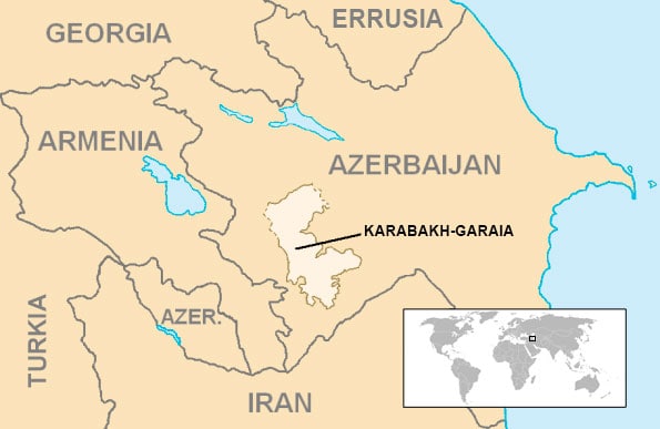
In the 1920s Armenia and Azerbaijan were under the control of the Soviet Union. The authorities drew complex borders that have become even more problematic once the two countries became independent in 1991. The region of Nakhchivan on the Turkish border had a majority Azerbaijani population, so it was given to Azerbaijan even though it is completely cut off from the rest of the country by Armenian territory. Yet, completely surrounded by Azerbaijani territory, the Armenian-majority region of Nagorno-Karabakh was given to Azerbaijan to rule as an autonomous region. Since independence, Armenia and Azerbaijan have fought two wars over Nagorno-Karabakh.
2. Belgium and the Netherlands
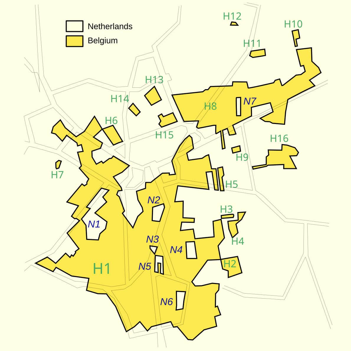
Many of the borders in Europe date back to the feudal period and were the product of complex dynastic issues between the various noble families. This has resulted in an extremely complex border situation in the towns of Baarle-Hertog in Belgium and Baarle-Nassau in the Netherlands.
There are 24 separate Belgian enclaves completely surrounded by Dutch territory and 8 little pieces of the Netherlands stranded inside Belgium. The border divides streets and individual houses, sometimes with different doors of a building opening onto different countries. This confusing situation has become easier to handle as both countries have become integrated into the European Union, using the same currency and having open borders.
3. Canada-Minnesota
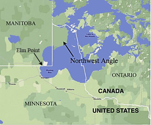
Minnesota has an odd little square bump called the Northwest Angle that protrudes into Canada. It’s a little corner of a peninsula jutting into the Lake of the Woods and only about 100 people live there. To get to the rest of Minnesota, though, they either have to drive through Canada or take a boat over the lake.
How did this happen? The U.S. and Britain, which was ruling Canada, agreed on the border at a time when the land had not been thoroughly explored and accidentally created this anomaly. The British and Canadians offered to purchase it, but the U.S. wasn’t interested in selling. Which makes you wonder whether there wasn’t anywhere some little piece of land along the border they couldn’t have swapped for it.
4. Central Asia
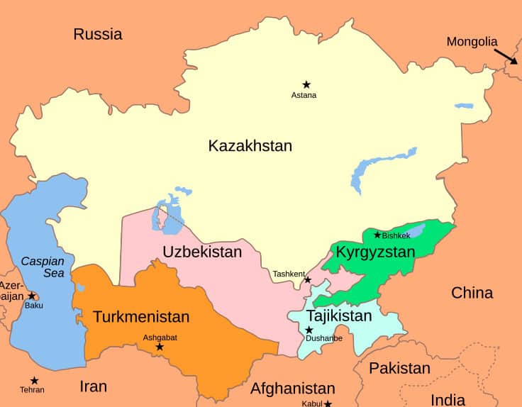
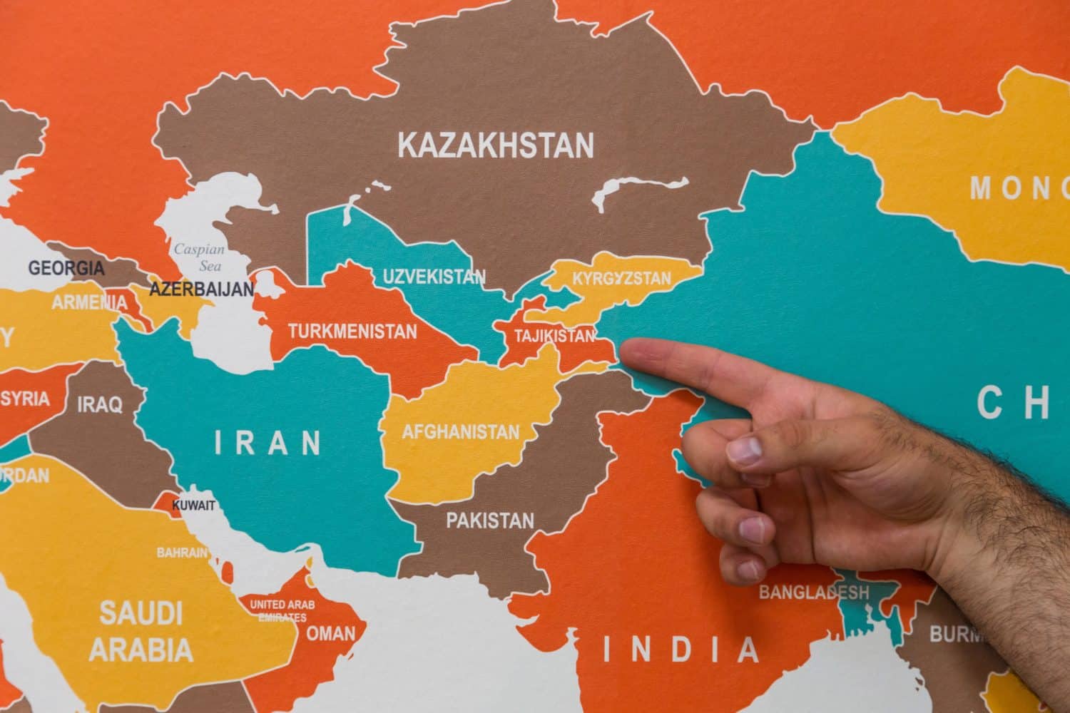
Located just north of Afghanistan, the countries of Tajikistan, Kyrgyzstan, and Uzbekistan come together in an oddly convoluted border that looks like the three countries are spiraling down into a black hole. The three countries meet in the Ferghana Valley, which is a heavily populated area settled by all three ethnic groups.
When they were part of the Soviet Union, the authorities ignored geographic realities and drew their borders in a way that would keep ethnic groups together but also prevent any one of them from getting stronger than the others. Now that they are all independent, the borders create logistic problems and tensions.
5. Chile
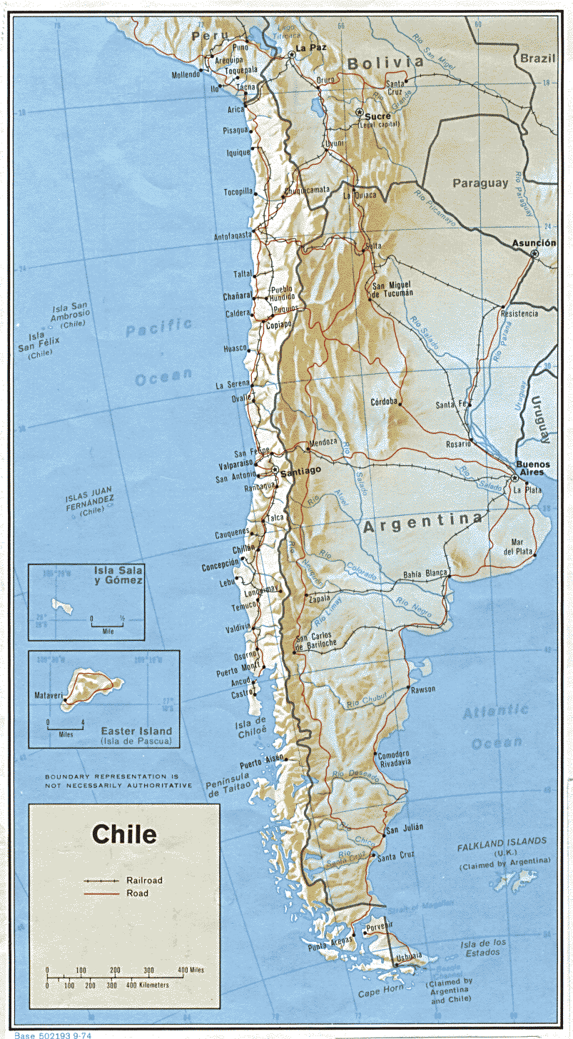
Literally all of Chile leaves people with one big question mark. It’s 2,600 miles long, just a little less than the distance from Maine to California, but averages only 110 miles wide. That’s about the length of New Jersey from North to South.
So why is Chile so long and narrow? It’s because of the Andes Mountains, one of the highest mountain ranges in the world with many peaks over 20,000 feet high. Chile’s eastern border runs along the Andes and its western border is the Pacific coast. Crossing the mountains is difficult and dangerous, leaving the western side isolated from the east. So it makes sense that each side would be under a different government. Most of the country’s population is in the central region, with a sparsely populated desert in the north and a largely uninhabited wilderness for hundreds of miles in the south. So the core of the country is more compact and makes more sense than a glance at the map would suggest.
6. India
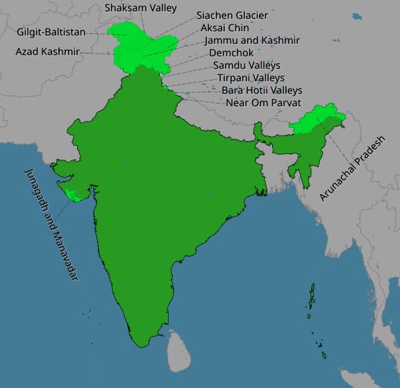
India was broken up in to hundreds of minor kingdoms and principalities before the British united the subcontinent under colonial rule. Hindus and Muslims were unable to agree with one another so the authorities delineated a separate Muslim country called Pakistan, that originally included Bangladesh on the eastern side of India. Bangladesh got its independence in 1971.
India’s borders with China are marked by the highest mountain range in the world: the Himalayas. Some small disputed areas were occupied by the Chinese in 1962 after a brief border war. Nepal and Bhutan were never colonized by the British and were friendly to India, so they retained their independence.
The worst problem on the Indian border is the division of Kashmir with Pakistan. This region in the far north of both countries was given the chance to choose which country to join but the Maharaja was indecisive and decided to join India only after an invasion from Pakistani tribes. The border between the two sides is still temporary, but heavily guarded, and the two countries have fought several wars.
7. Israel/Palestine
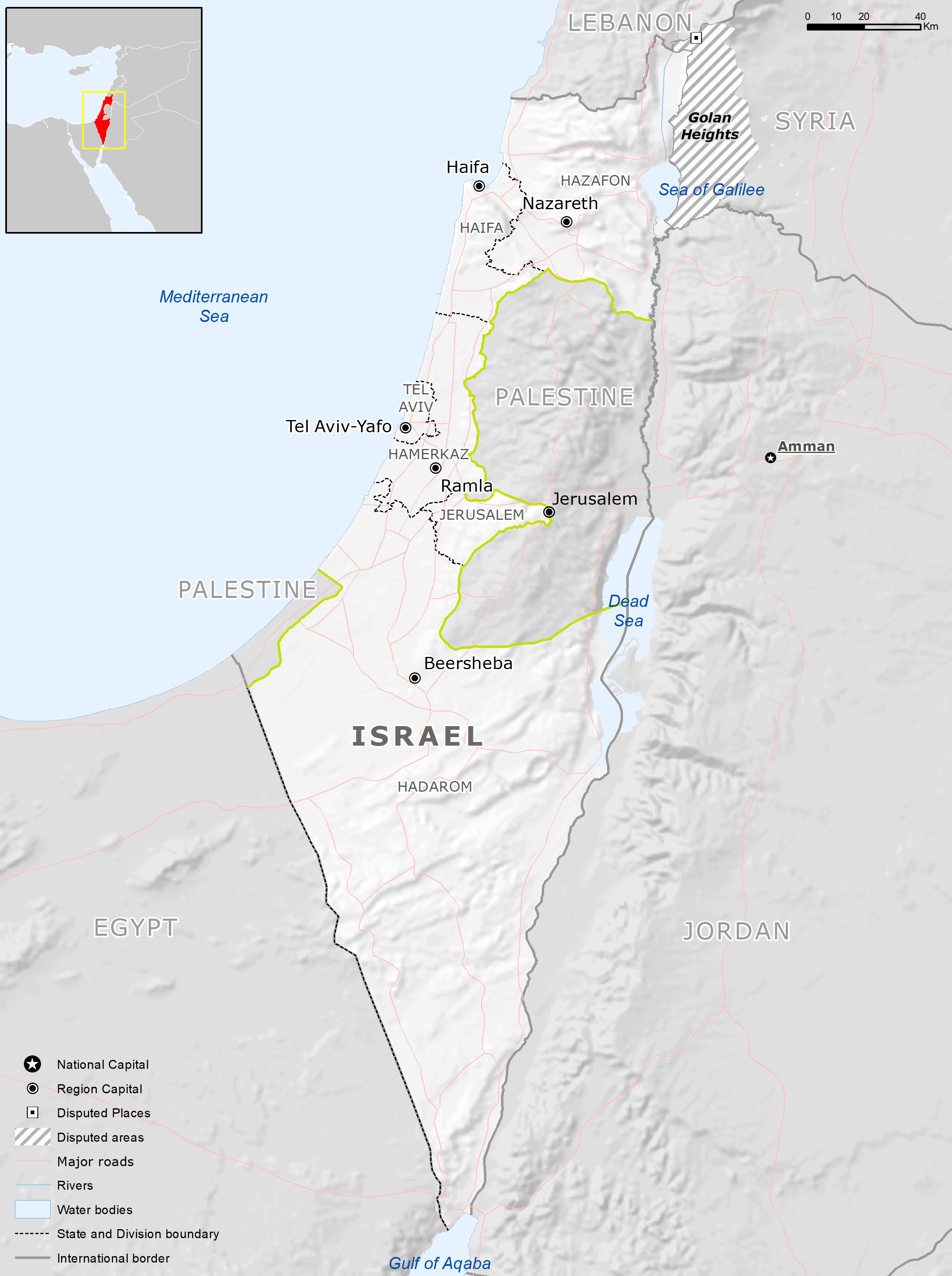
Palestine was a British colony with feuding Jewish and Arab populations. Tensions became worse after World War II as more Jews immigrated there. Israel accepted a U.N. plan for dividing the land, but the Arabs did not. Israel declared independence in 1948 and fought off an invasion that started the next day by all its neighbors plus Iraq. The war ended with Israel controlling the Galilee region in the north and the Negev desert in the south connected by a coastal strip that was only 9 miles wide at its narrowest.
Later, in a 1967 war, Israel took control of the West Bank and Gaza Strip, which gave them a geographically consolidated country controlling all the territory between the Jordan River and the Mediterranean Sea. The international community does not recognize these conquests, though, so Israel has not been able to annex these territories as it certainly would like to do, given the chance. Instead, over the decades they have allowed their settlers to move in and establish new heavily-guarded Jewish communities, and they have built a 440-mile border wall/fence to prevent attacks from militants. This is widely seen as a creeping annexation of at least parts of the West Bank.
8. Malaysia
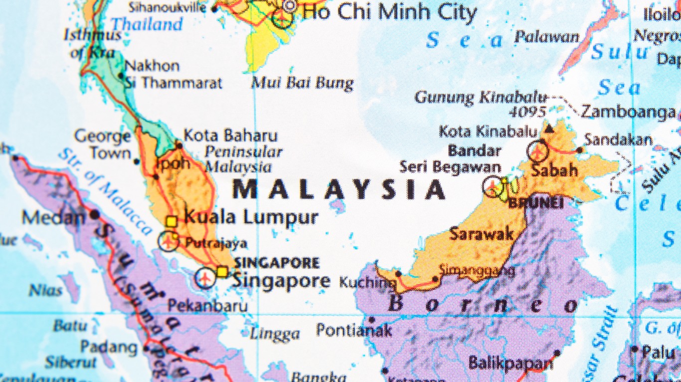
Malaysia is divided in half, with West Malaysia on the Malay Peninsula and East Malaysia located 670 miles away across the South China Sea on the northern coast of Borneo. The distance between them has created significant logistical, ethnic and cultural differences and might threaten the country’s unity in the future unless they are handled carefully. This odd situation exists because both halves of the country were British Colonies, while the Dutch controlled the rest of Borneo and the other islands that today make up Indonesia.
9. Senegal and Gambia
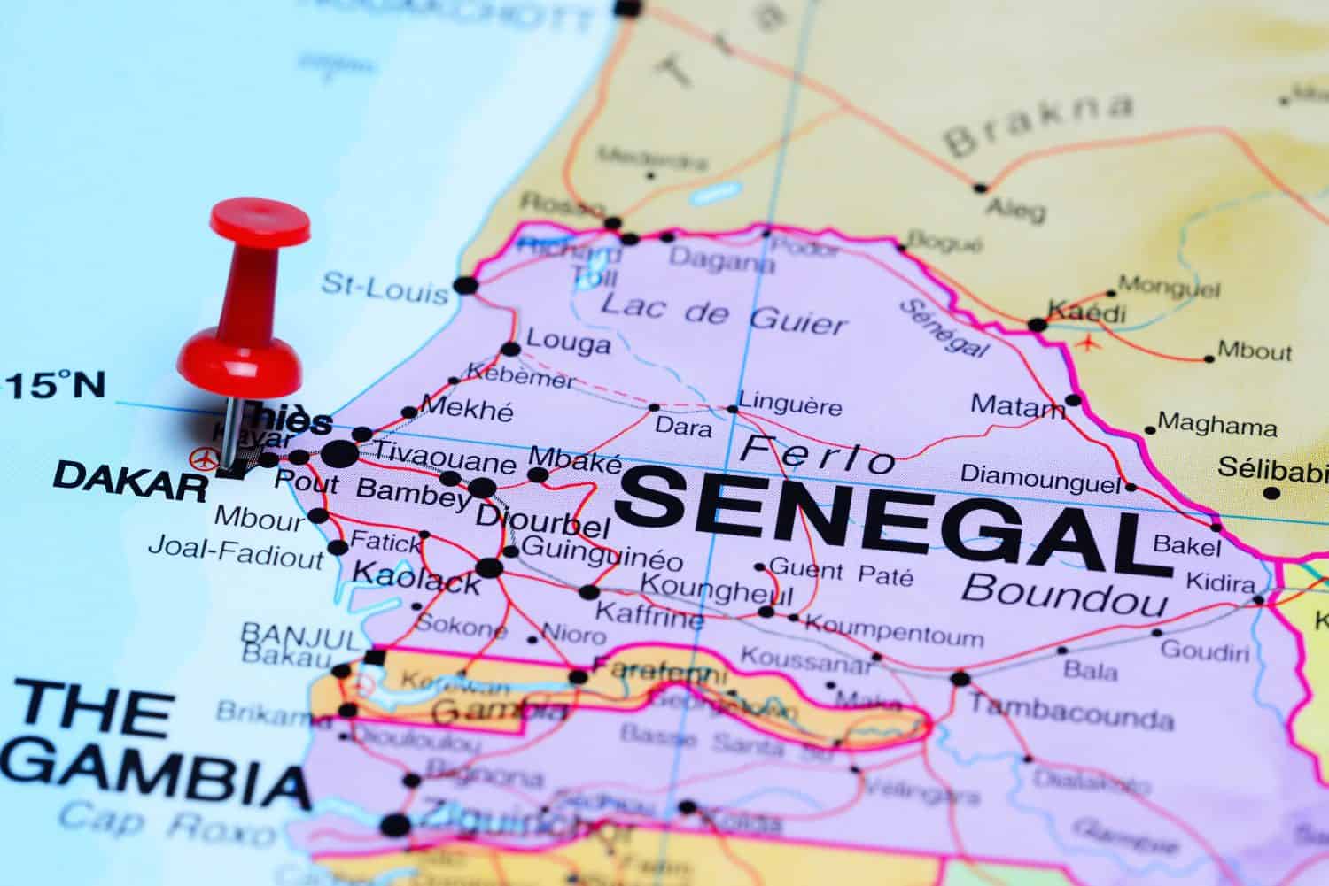
A very strange African border situation in West Africa is the result of colonial empires claiming different pieces of territory. Britain laid claim to 200 miles of the Gambia River and the coast on either side, which was valuable to them to be able to control trade routes and military access to this strategic river. This resulted in the modern country of Gambia, which is only 30 miles wide at its widest point. But what makes it even weirder is that it is completely surrounded on all its land borders by Senegal, a former French territory.
The idea of merging the two countries has come up but has not gained any traction. From their separate colonial pasts, these countries speak different languages and have different cultures and seem to be doing fine as they are.
10. Spanish Enclaves in Morocco
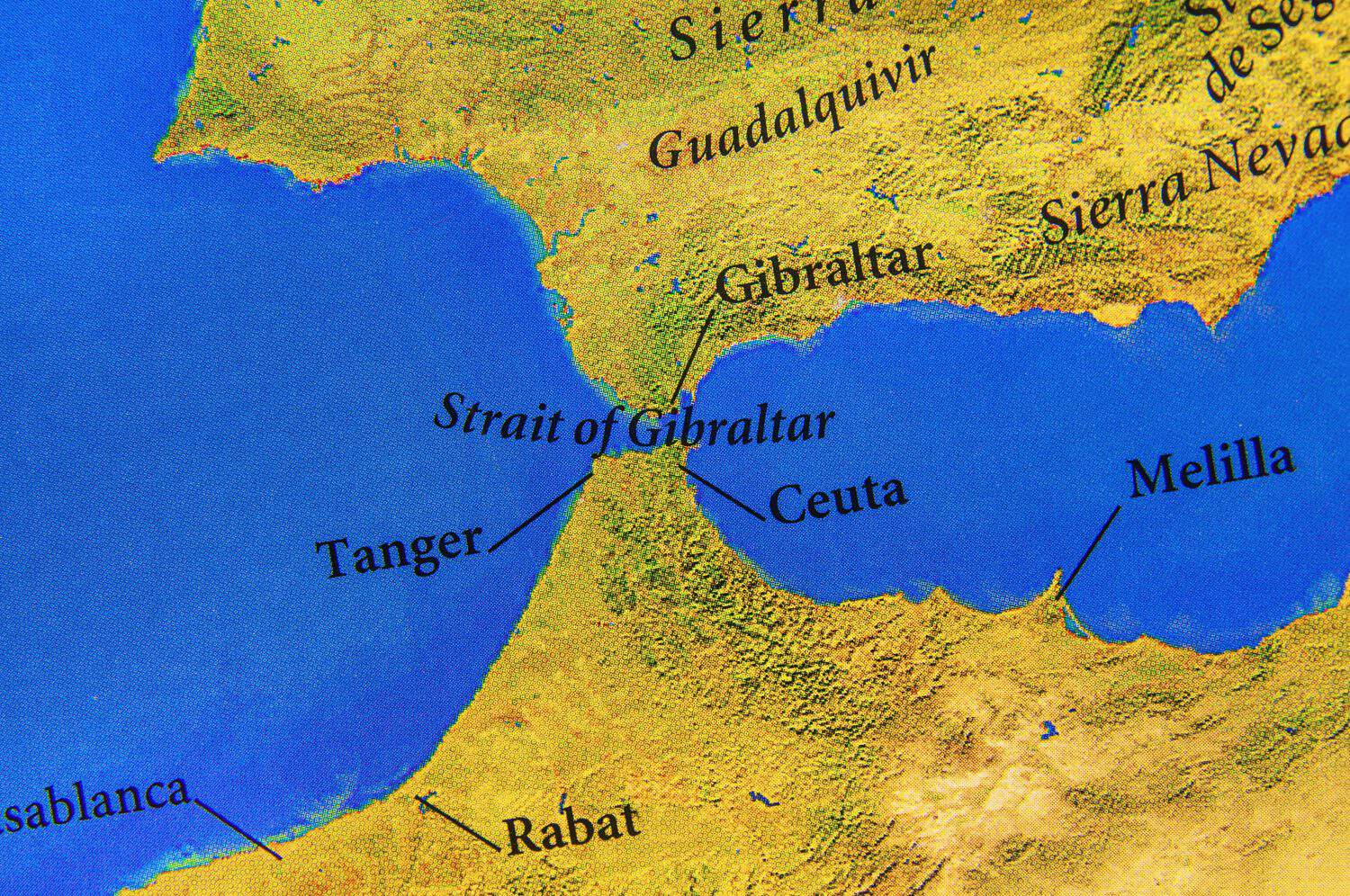
Spain controls several small enclaves on the coast of Morocco that are remnants of a colonial past. Morocco would like Spain to hand them over, but the Spanish have ruled the enclave of Melilla for 527 years and Ceuta for 356 years. By now, up to 60 percent of the population of both enclaves is Spanish. Moreover, both cities are strategically located for trade and military defense of the Strait of Gibraltar. But Spain gets a dose of its own medicine, because the United Kingdom still controls Gibraltar, a peninsula on the coast of Spain that helps guard the entrance to the Mediterranean Sea. And the British have been there for 311 years, so . . .
11. Vietnam
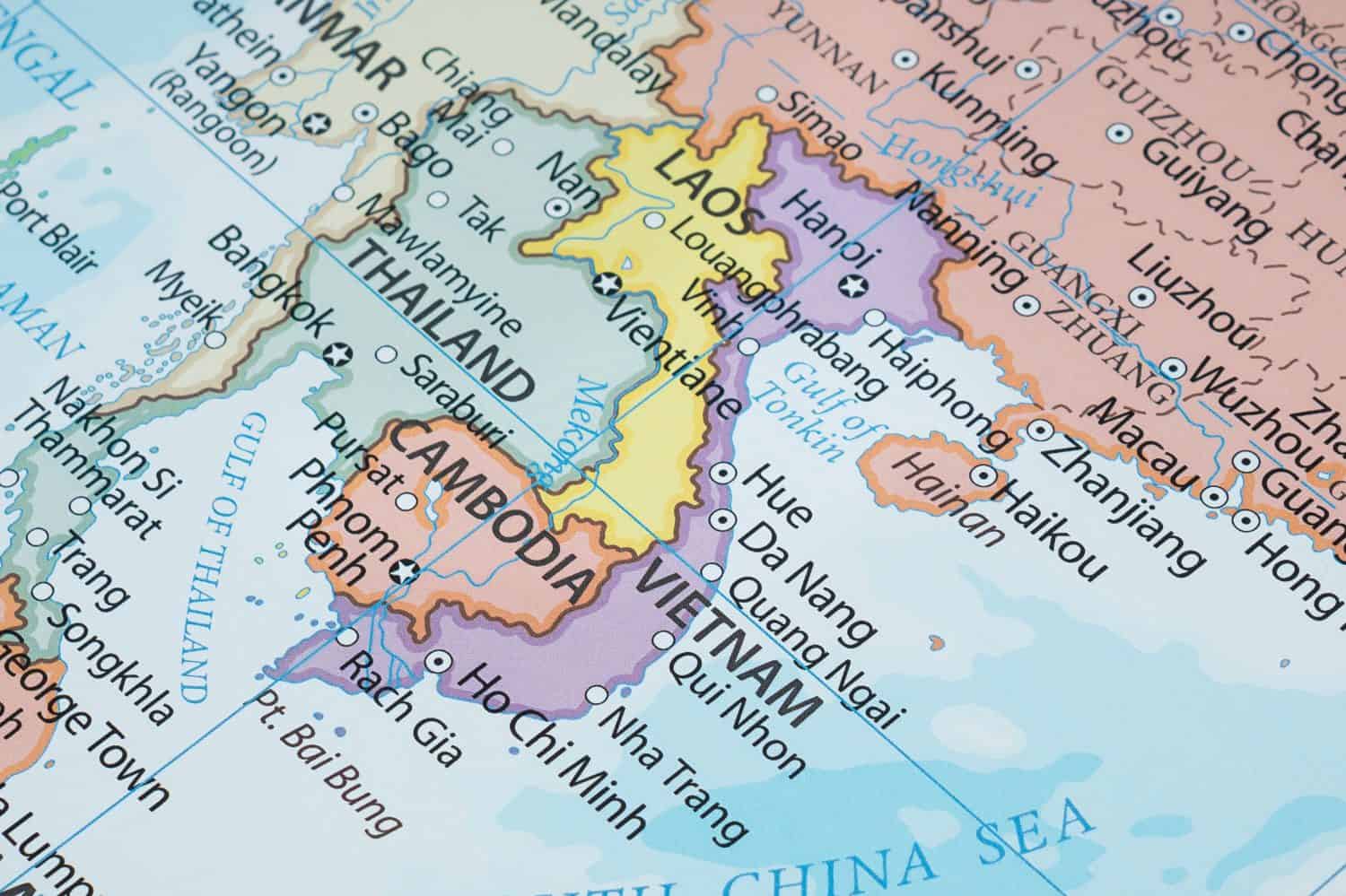
Like Chile, Vietnam is long and narrow, and for similar reasons. The Annamite mountain range runs along much of the western border, separating the country from Laos and Cambodia. In the north and south, the Red River Delta and the Mekong Delta are fertile, well-watered agricultural areas where most of the population is concentrated. These north-south population concentrations also help us understand how North and South Vietnam emerged as rival power centers during the Vietnam War.
Are You Ahead, or Behind on Retirement? (sponsor)
If you’re one of the over 4 Million Americans set to retire this year, you may want to pay attention. Many people have worked their whole lives preparing to retire without ever knowing the answer to the most important question: are you ahead, or behind on your retirement goals?
Don’t make the same mistake. It’s an easy question to answer. A quick conversation with a financial advisor can help you unpack your savings, spending, and goals for your money. With SmartAsset’s free tool, you can connect with vetted financial advisors in minutes.
Why wait? Click here to get started today!
Thank you for reading! Have some feedback for us?
Contact the 24/7 Wall St. editorial team.
