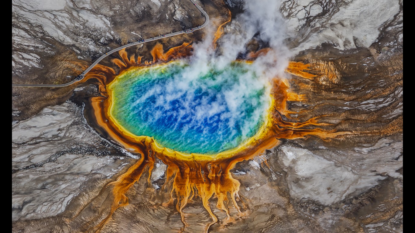
There are many mysterious phenomena and locations on the planet, from haunted castles to flames that rise out of stone to what appears to be a waterfall of blood – and although some have reasonable explanations, they still incite myths, rumors, and folk legends.
24/7 Tempo has compiled a list of 45 of the most mysterious places on earth by reviewing dozens of travel sites and encyclopedic sources for information on natural wonders and man-made marvels that have mythical origins or offer unexplained experiences. Every continent is represented, as are some of the most remote islands in the world. (These are the most colorful natural wonders on earth.)
Some of the most mysterious places on earth are man-made, including secret military bases, haunted mansions, and eccentric architectural constructions. Others are natural wonders, including colorful acid lakes, deep underwater sinkholes, and strange rock formations. (There are many amazing sites in our own country. Here are stunning photos of America’s largest attractions.)
Click here to see the most mysterious places on Earth
A few of these places are the sites of mysterious disappearances while others harbor gravity-defying optical illusions. Local legends of hauntings, extra-terrestrials, and mythical creatures still surround some of these sites, many of which have become popular tourist attractions, drawing visitors with their perplexing or unsettling qualities.
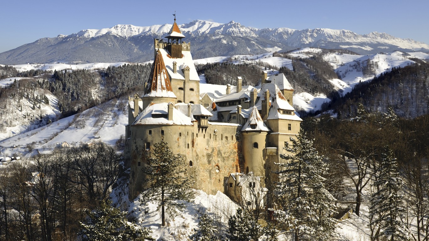
Bran Castle
> Location: Bran, Romania
This Transylvanian castle is rumored to be the inspiration behind Dracula’s Castle in Bram Stoker’s novel “Dracula.” Although Vlad the Impaler – commonly thought to be the inspiration for Count Dracula – likely never stepped foot in the castle, local myths in the surrounding villages tell of spirits who walk as humans during the day but torment and haunt villagers at night.
[in-text-ad]
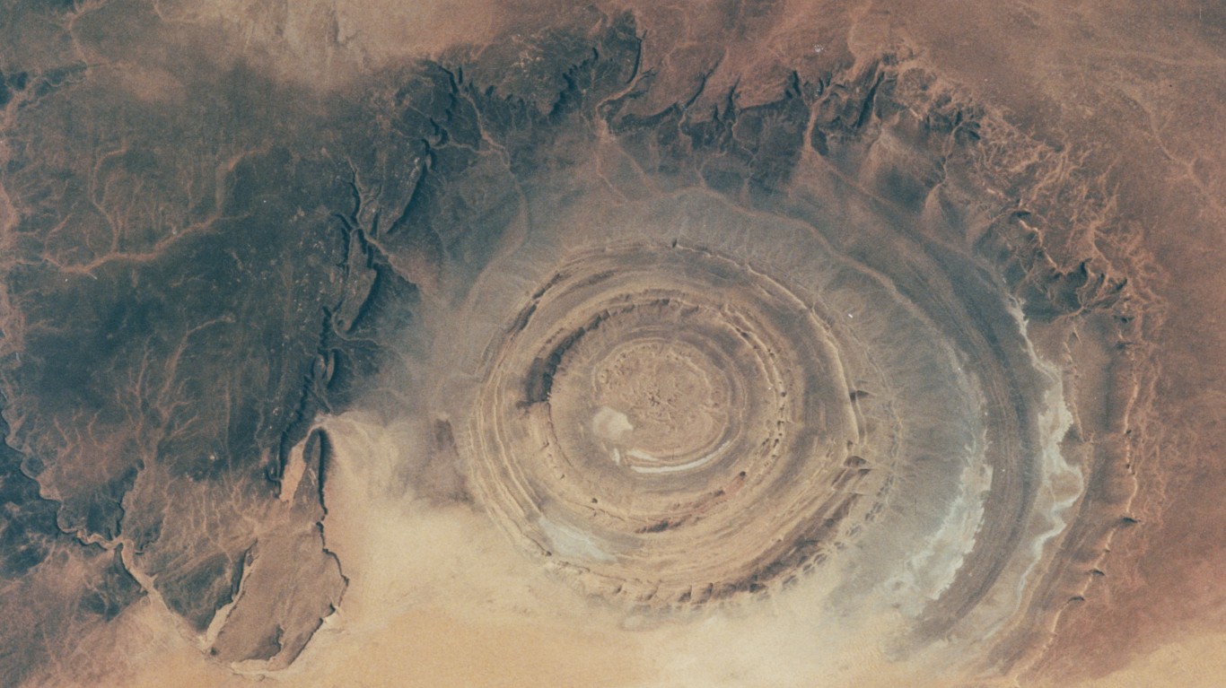
Richat Structure
> Location: Adrar Plateau, Mauritania
Also known as the Eye of the Sahara, the Richat Structure is visible from space and was first thought to be an impact crater when it was observed from space by astronauts in the ’60s. Resembling a huge bullseye, the formation is actually an eroded geological dome that is 25 miles in diameter and contains rocks that are 100 million years old.
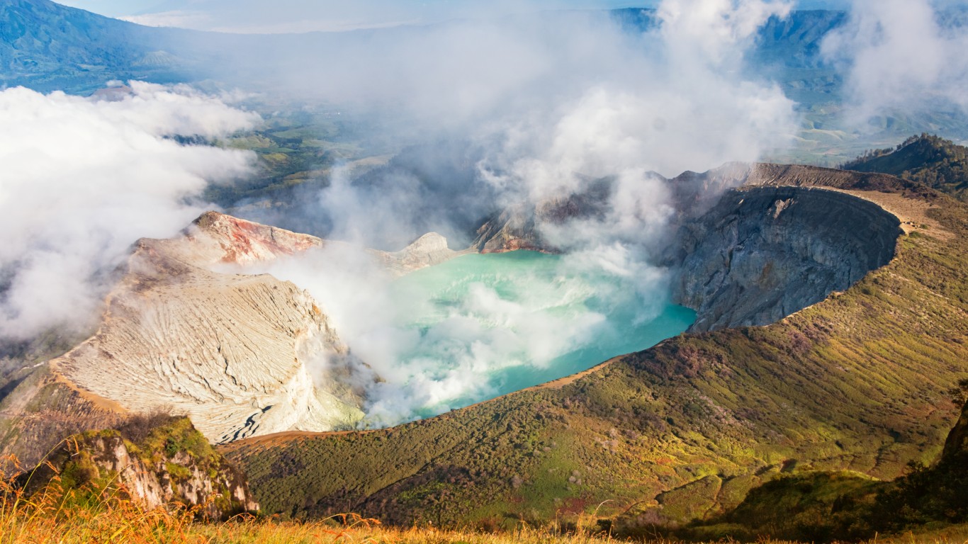
Kawah Ijen Lake
> Location: Between Banyuwangi and Bondowoso regencies, Indonesia
The largest acid lake in the world, Kawah Ijen Lake is a bright turquoise caldera lake in a volcanic crater on the island of Java. Sulfurous volcanic gasses rise from vents around the lake and often ignite as they hit oxygen, causing an eerie scene at night, when electric blue flames can be seen glowing in the fog.
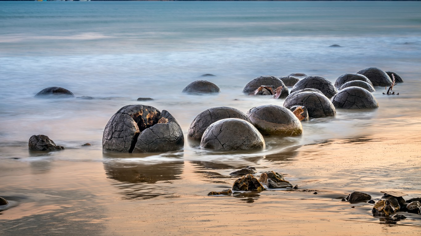
Moeraki Boulders
> Location: Between Moeraki and Hampden, New Zealand
These oddly spherical boulders dot a section of the Koekohe Beach on the Otago Coast of New Zealand’s South Island, where they have emerged from eroding mudstone cliffs. Formed by calcite deposits that slowly built up around a central nucleus, the round concretions have cracked exteriors filled with mineral deposits, which give them the illusion of being large dinosaur eggs. Māori legend dictates that they are remnants of food and baskets that washed ashore from the wreck of a canoe that carried some of their ancestors to the islands.
[in-text-ad-2]
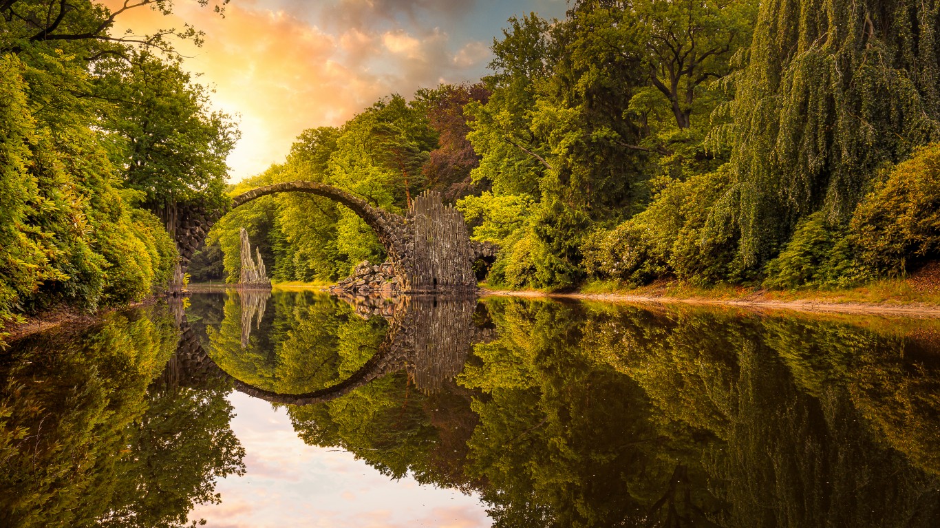
Rakotzbrücke
> Location: Gablenz, Germany
Commissioned in 1860, Rakotzbrücke is a half-circle bridge built as an aesthetic monument rather than a functional structure. It is also called Teufelsbrücke, or Devil’s Bridge, because its design makes it incredibly dangerous to cross. The bridge’s reflection in the water beneath it appears to form a full circle, and local stones shaped like basalt columns decorate the ends of the walkways.
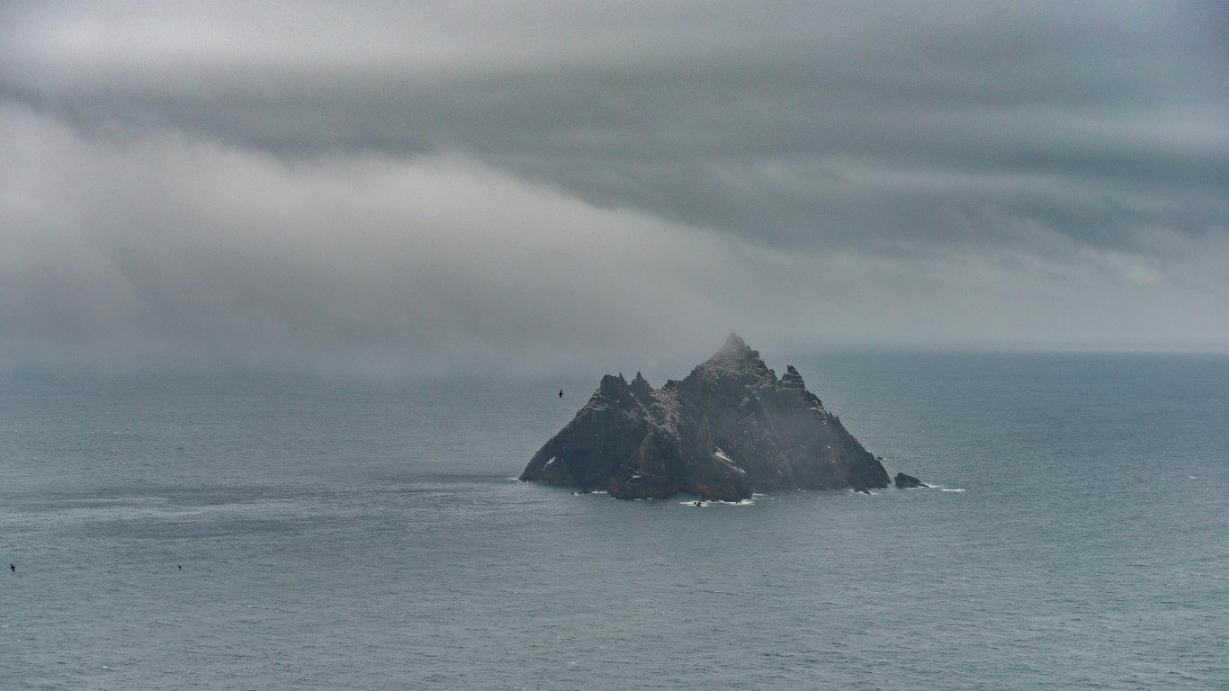
Skellig Michael
> Location: Country Kerry, Ireland
The island of Skellig Michael is a twin-peaked crag off the southwestern coast of Ireland. It was home to a monastery from the sixth to the 13th centuries, where monks lived in stone huts shaped like beehives. The ruins of the monastery, including several of these huts, a church, and a graveyard, can be accessed by climbing a winding stone staircase over 600 steps long.
[in-text-ad]
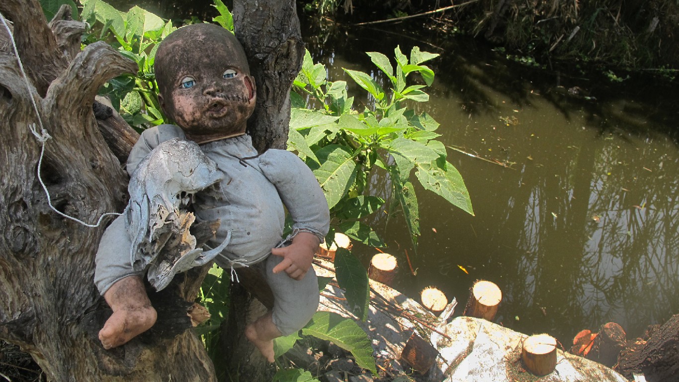
Island of the Dolls
> Location: Channels of Xochimilco, Mexico
The Island of the Dolls – La Isla de las Muñecas in Spanish – is an island covered in decaying, hanging dolls. It’s creepy enough on its own – but its backstory is even creepier. According to local legend, the island’s hermit caretaker, Julián Santana Barrera, found the body of a young girl who drowned in a canal in the 1950s. To appease her spirit, he hung up a doll that he believed was hers.
Over the years, he hung more and more dolls and doll body parts, believing that the girl’s spirit possessed the toys. Santana himself died in 2001, his body discovered near the spot where he’d found the girl decades before. The island remains a tourist attraction that some say is still haunted by the girl’s spirit.
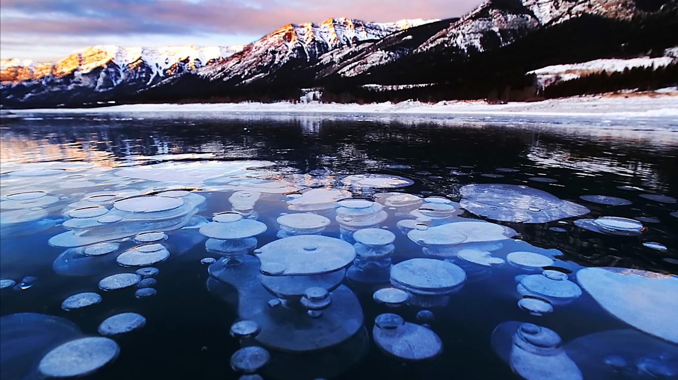
Abraham Lake
> Location: North Saskatchewan River, Alberta, Canada
The largest man-made reservoir in Alberta, Abraham Lake derives its milky blue hue from a silt of glacial flour, small bits of rock that were ground down by glacial action. When the lake freezes over in the winter, pockets of methane gas formed by decaying plants rise up from under the lake to form stunning stacks of frozen bubbles near the lake’s surface.
Lake Maracaibo
> Location: Zulia, Venezuela
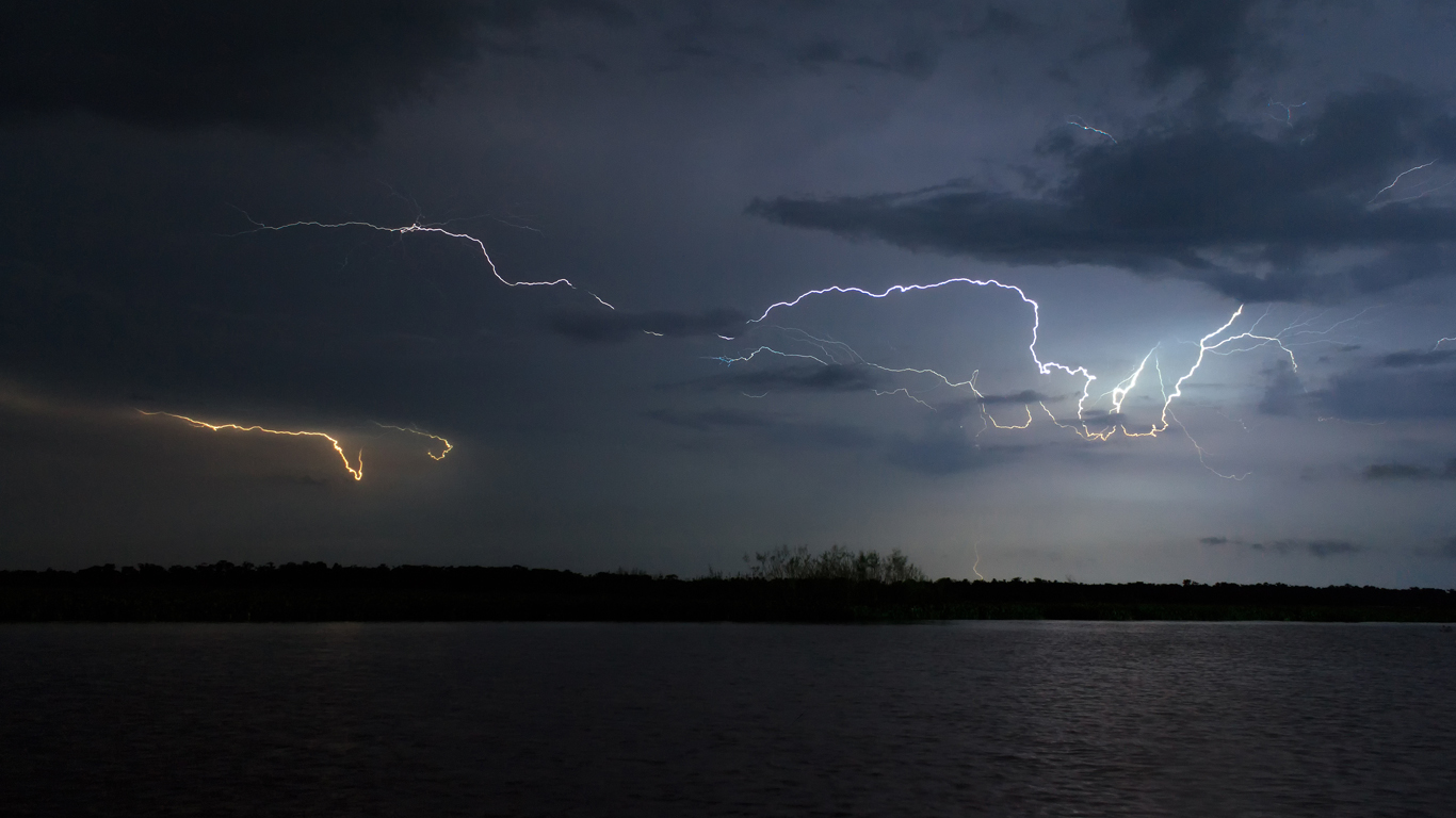
The so-called Lightning Capital of the World, Lake Maracaibo is illuminated by lightning storms nearly 300 nights of the year, with over 600 bolts of lightning per square mile annually – and no thunder. The lightning is so consistent and predictable that ships used to use it for navigation. Called Catatumbo Lightning after the Catatumbo River that flows into the lake, the phenomenon has been studied by numerous scientists, and is thought to be caused by numerous overlapping climatic factors.
[in-text-ad-2]
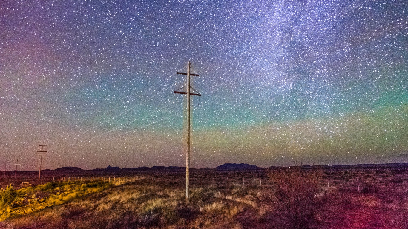
Marfa Lights
> Location: Marfa, Texas
Since the 1880s, residents of Marfa, Texas, and the surrounding area have been reporting strange lights visible some evenings in a stretch of uninhabited desert south of town. The lights, which can be white, blue, or red, appear out of nowhere, sometimes flickering, hovering, slowly rising, disappearing, then reappearing again. An official viewing zone east of town sees visitors from around the world. Although some scientists have posited that the lights are atmospheric phenomena or car headlights, the mystery remains unsolved.
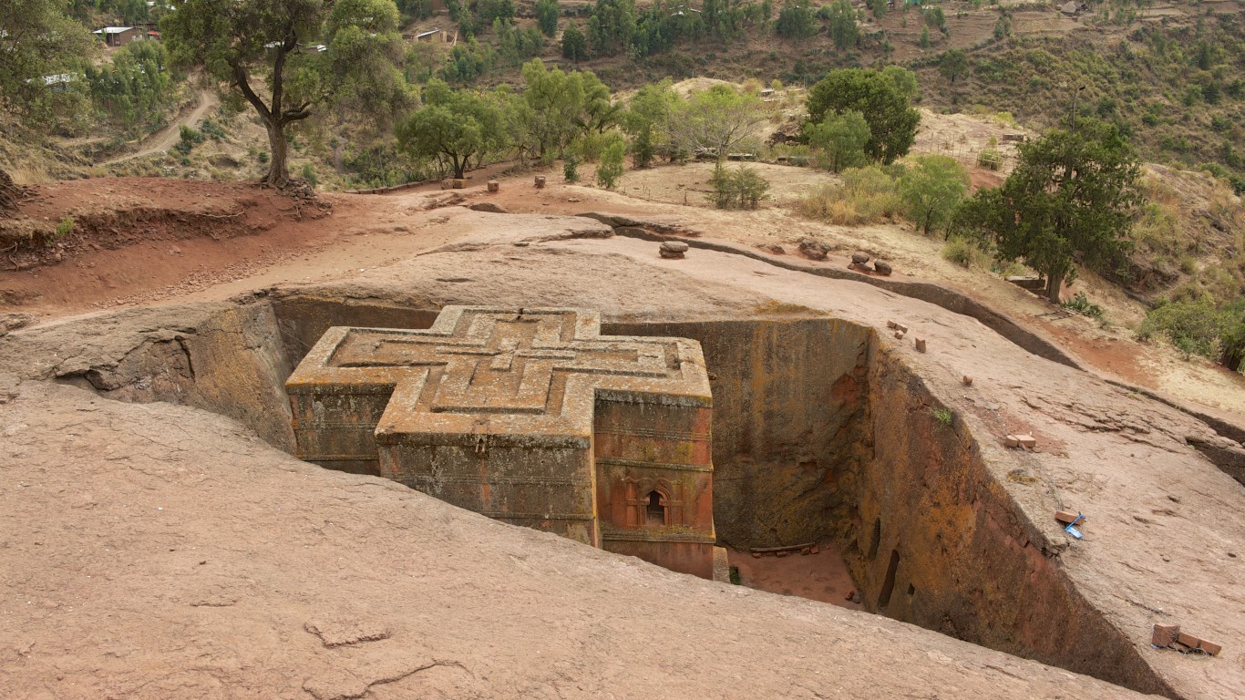
Rock-hewn churches
> Location: Lalibela, Ethiopia
Near the town of Lalibela in the Ethiopian highlands, are 11 medieval monolithic churches carved straight out of the basalt rock landscape. Commissioned by King Lalibela in the late 12th century, the churches were meant to form a New Jerusalem that Christians could visit after the Muslim conquest of Jerusalem prevented Christian pilgimages to the Holy Land. Connecting some of the churches are a series of drainage ditches, tunnels, and passageways leading to catacombs and hermit caves. The site remains important to Ethiopian Orthodox Christians and is used daily for worship and prayer.
[in-text-ad]
Slope Point
> Location: Waikawa, New Zealand
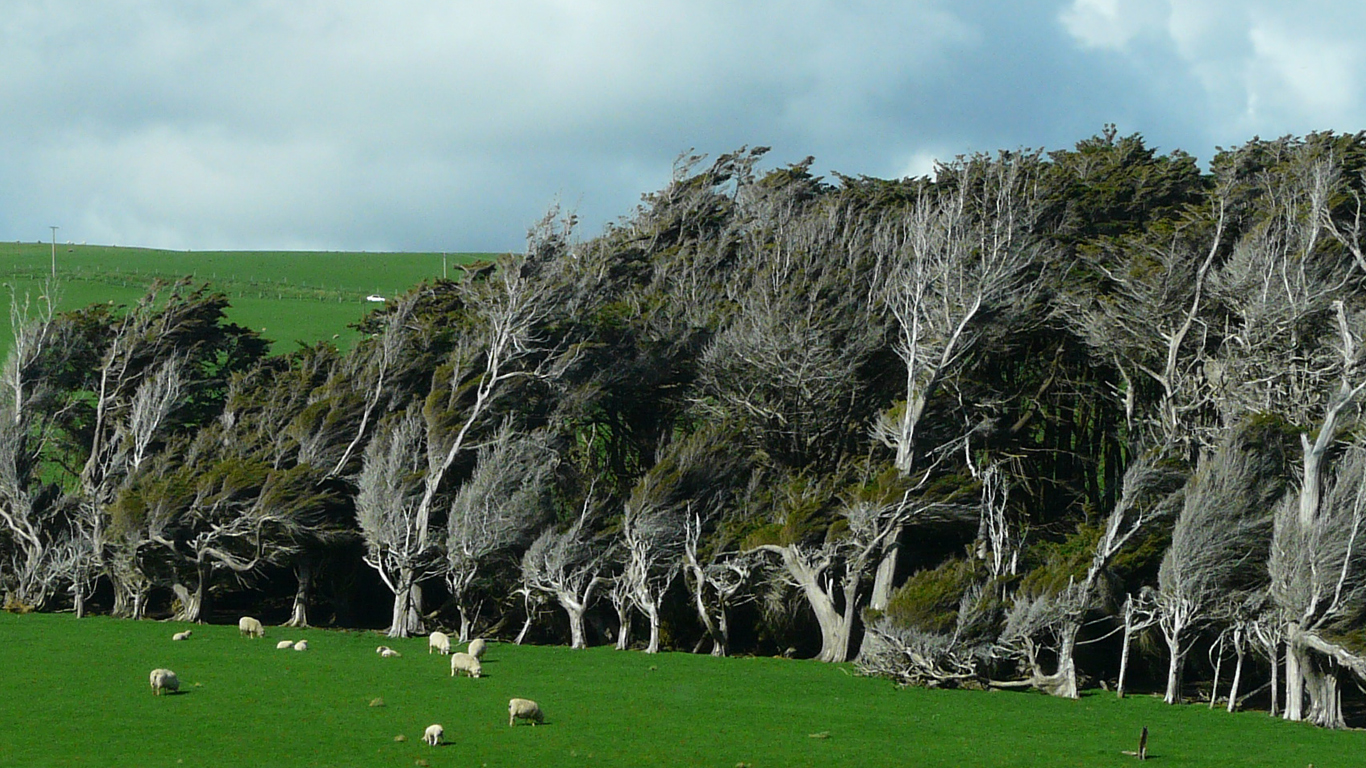
The southernmost point on New Zealand’s South Island is a wind-swept landscape of rugged cliffs and eerily disfigured trees that appear to be blowing over sideways. The harsh Antarctic winds that sweep through have permanently bent the trees northward. Planted by local sheep farmers as a refuge to give their sheep respite from the winds and rain, the trees have borne the brunt of the weather on an otherwise bare promontory.
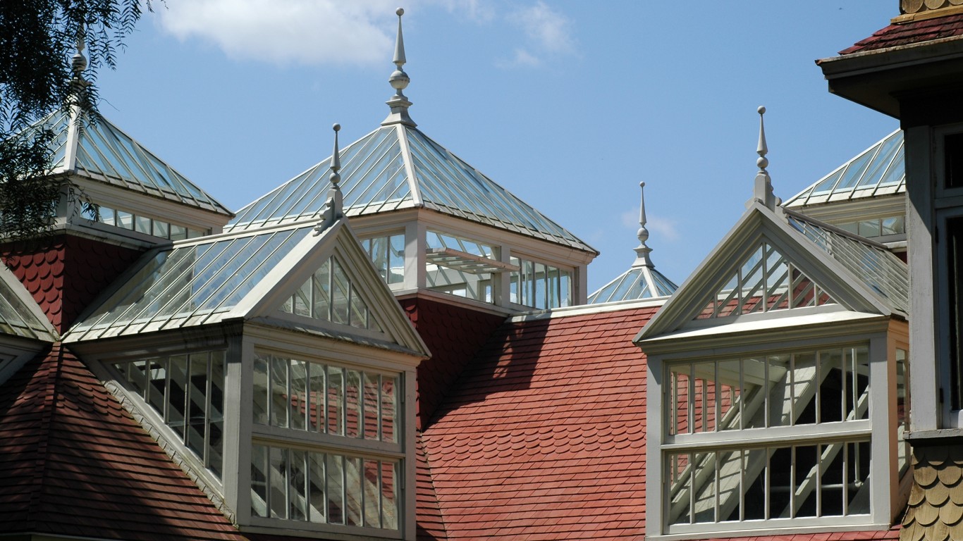
Winchester Mystery House
> Location: San Jose, California
A tangled mansion of secret passageways, staircases to nowhere, and doors that lead to multi-story drops, the Winchester Mansion is known as one of the most haunted places in California. Built by widow Sarah Lockwood Winchester, heiress to the Winchester rifle fortune, the mansion saw continued construction and renovation for 38 years until Winchester’s death in 1922. According to local legend, Sarah was haunted by ghosts of the men killed by Winchester rifles, and in order to elude them, she took outlandish paths through the house and slept in a different room each night.
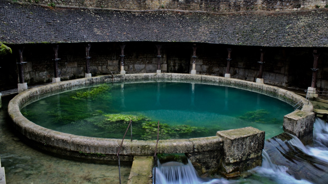
Fosse Dionne
> Location: Tonnerre, France
This mysterious karstic spring in Tonnerre has been a vital source of water for the area’s residents since at least the sixth century, gushing an incredible 80 gallons per second and inspiring legends and tales about what lies at the bottom. Its source, however, remains unknown. Partially fed by rainwater and an underground river, the spring has been explored by numerous divers since 1955 – some of whom died in the process – but nobody has been able to find where it originates.
[in-text-ad-2]
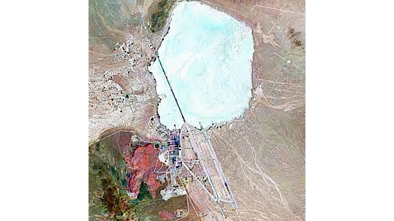
Area 51
> Location: USAF Nevada Test and Training Range, Nevada
A U.S. Air Force facility that was not officially acknowledged by the government until 2013, Area 51 (officially called Homey Airport or Groom Lake) has been the topic of numerous conspiracy theories involving extraterrestrials and U.F.O.s. Many U.F.O. sightings have been reported in the area. While its stated use is as an aircraft testing site – which may explain the sitings – multiple people claiming to be former workers have reported that the site was harboring and reverse-engineering technologies from crashed alien spacecrafts, and one man claims to have seen photos of alien autopsies inside the base.
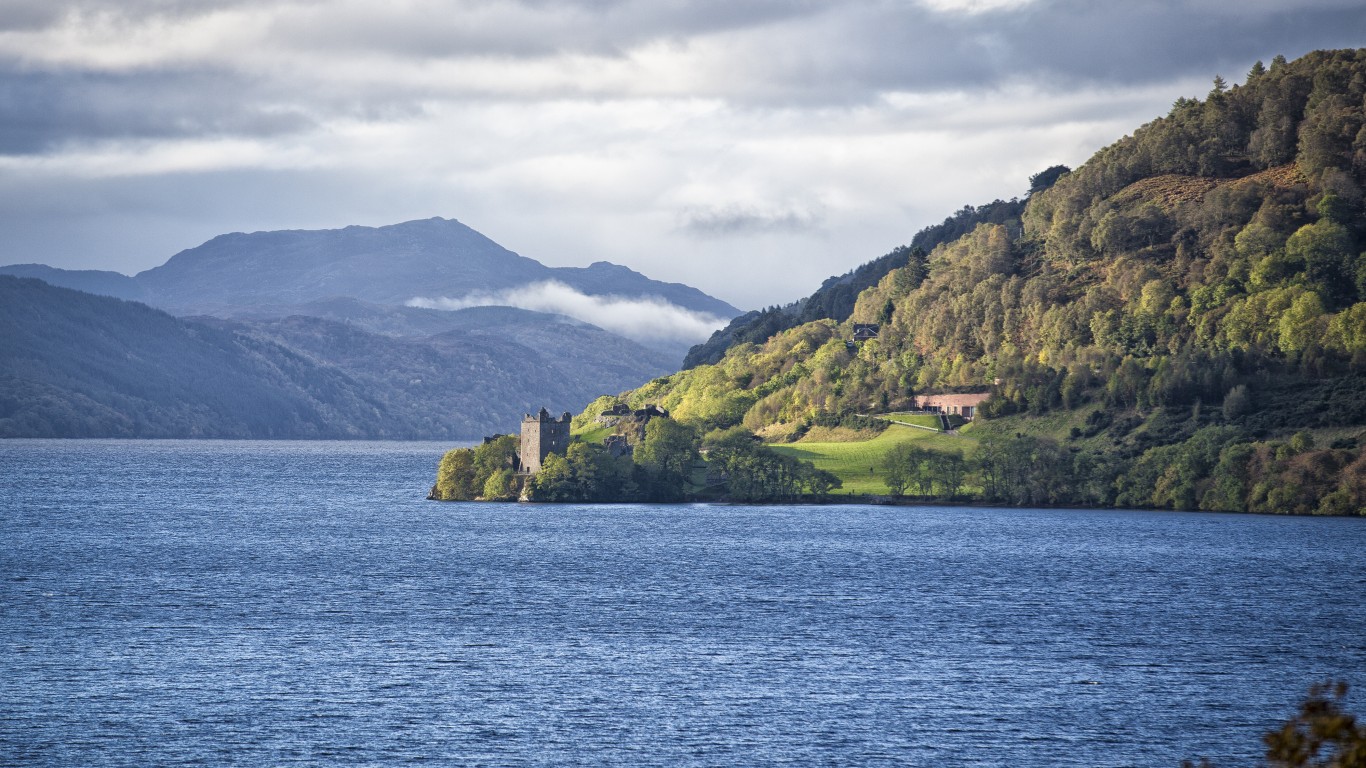
Loch Ness
> Location: Loch Ness, Scotland
This large freshwater lake in the Scottish Highlands is purported to be the home of a prehistoric creature called the Loch Ness Monster, popularly known as Nessie. Scottish folklore has long told of a finned beast with a humped back who inhabits the lake, and ancient Pict stone carvings in the area also depict the creature. A fifth-century account of the life of Saint Columba tells the story of a man killed by the beast, after which the saint commanded it to retreat. Although some 20th-century sightings have been sxposed as hoaxes, videos, photos, and alleged sightings persist.
[in-text-ad]
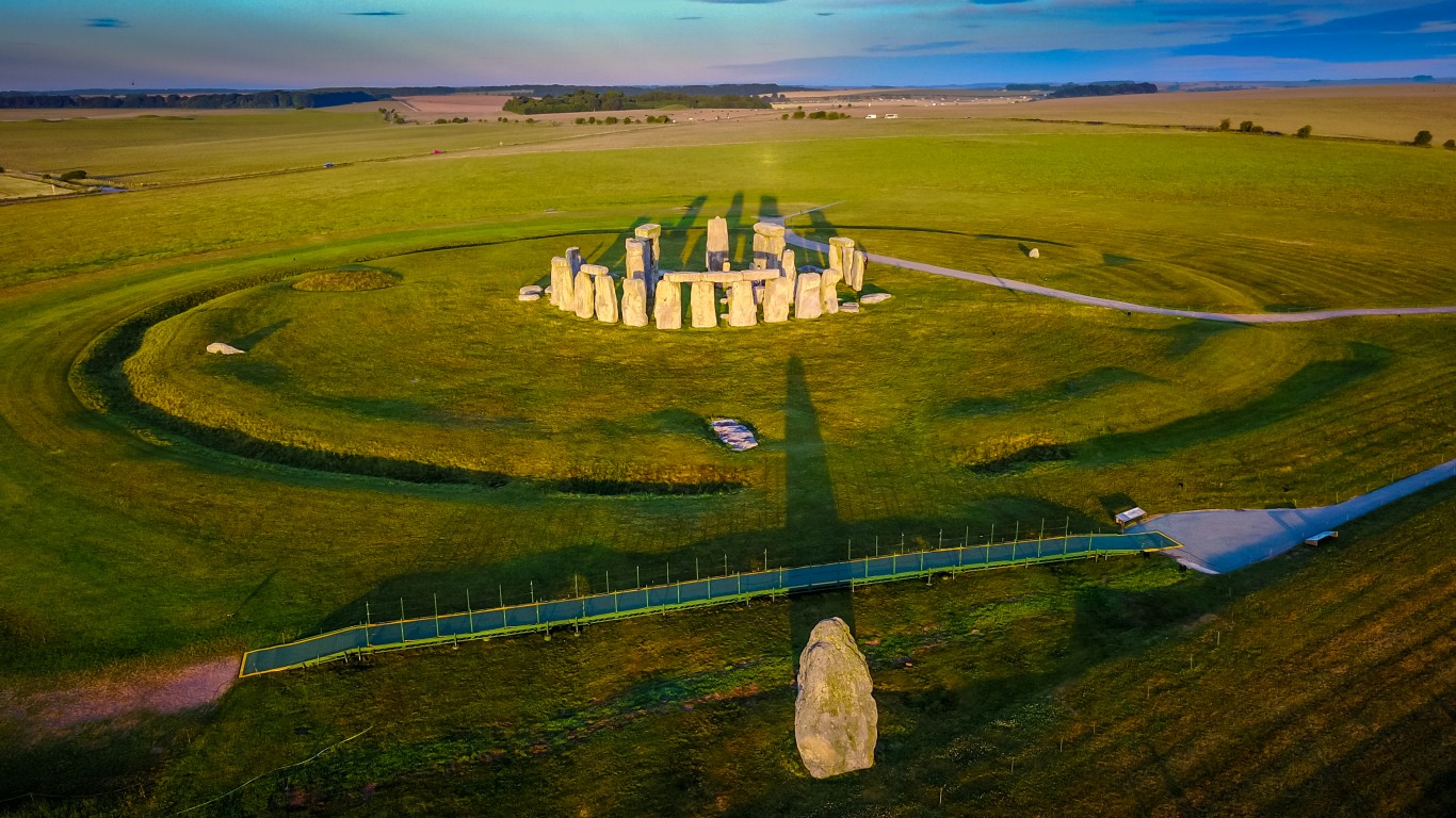
Stonehenge
> Location: Salisbury Plain, England
The most architecturally sophisticated prehistoric stone circle in the world, Stonehenge was built over 5,000 years ago and has seen many stages of use, with burial mounds and bones from the site spanning thousands of years. It is estimated that hundreds of cremation burials have taken place at the site, which was possibly used for religious, healing, or astronomical purposes. The entrance is aligned with the rising sun on summer solstice, suggesting it may have also served as a calendar.
It has long been known that most of the stones that make up the monument are from 140 miles away in South Wales, but a study published in 2021 suggests that the monument originally stood in Wales, close to where the rocks were quarried from, and was moved to its current location around 3,000 BC. To this day, the purpose and history of Stonehenge remains shrouded in mystery.
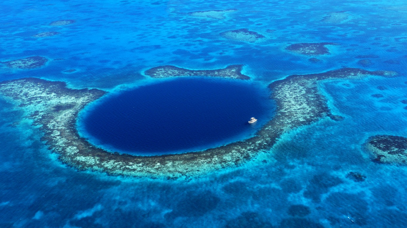
Great Blue Hole
> Location: Lighthouse Reef, Belize
For years, this underwater sinkhole off the coast of Belize drew adventurous snorkelers and scuba divers, but none who’d ventured to the bottom. In 2018, a submarine crew finally descended further into the hole than anyone had ever gone and discovered that it was once a dry cave. No life exists in the bottom levels of the hole, due to a layer of toxic hydrogen sulfide, but stalactites and a graveyard of marine life lay in the depths of the cave – along with the bodies of a few divers who went missing while exploring the site.
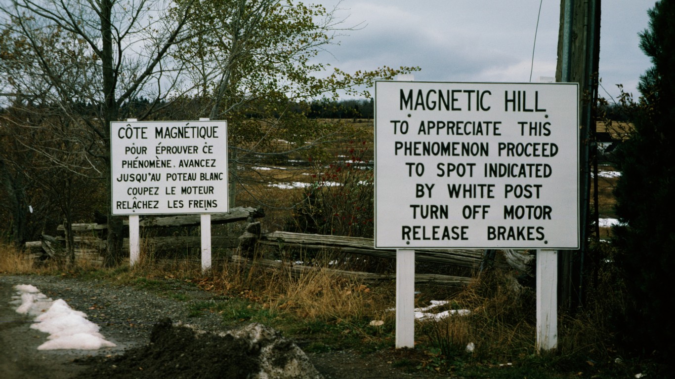
Magnetic Hill
> Location: Moncton, New Brunswick, Canada
This optical anomaly has become a popular tourist attraction, where drivers can put their cars in neutral and appear to be getting pulled backward, seemingly uphill, by invisible forces. Water flowing nearby also appears to run uphill. Visitors have flocked to the site since a road was built there in 1931, revealing the seemingly gravity-defying phenomenon.
[in-text-ad-2]
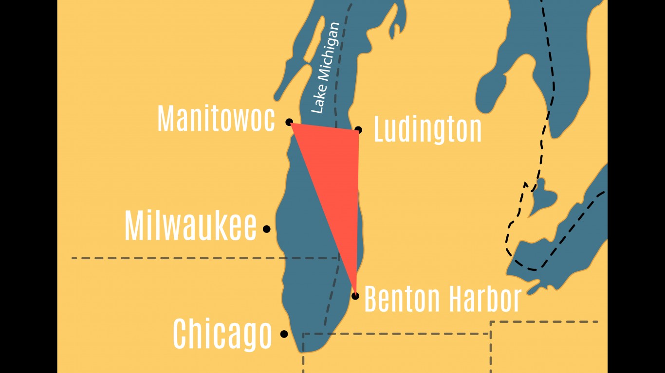
The Michigan Triangle
> Location: Lake Michigan, Wisconsin and Michigan
For hundreds of years, a section of water in Lake Michigan has been the site of numerous unexplained events. Since the 17th century, multiple ships as well as a flight carrying 58 people have disappeared there, never to be recovered. In 1931, another ship was found overturned, with all onboard dead. It appeared that the ship had collided with something, yet nothing was found that could have caused the collision. In addition to these accidents, a ship captain vanished from his locked cabin one evening in 1937, and strange lights as well as falling blocks of ice have been reported over the area.
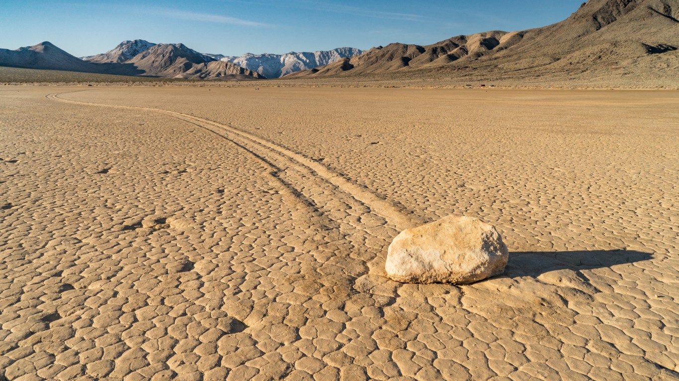
The Racetrack
> Location: Death Valley, California
The Racetrack, also called Racetrack Playa, is home to the moving rocks of Death Valley. These rocks have intrigued scientists and visitors for decades by mysteriously traveling without human intervention and leaving long trails in the cracked, dry, earth. In 2014, researchers may have solved the mystery after witnessing the rocks moving as a result of winter rains. Pools of rainwater began to freeze, forming thin layers of surface ice that eventually broke into sheets that could float and move in the wind, shoving the rocks in front of them.
[in-text-ad]
Eternal Flame Falls
> Location: Orchard Park, New York
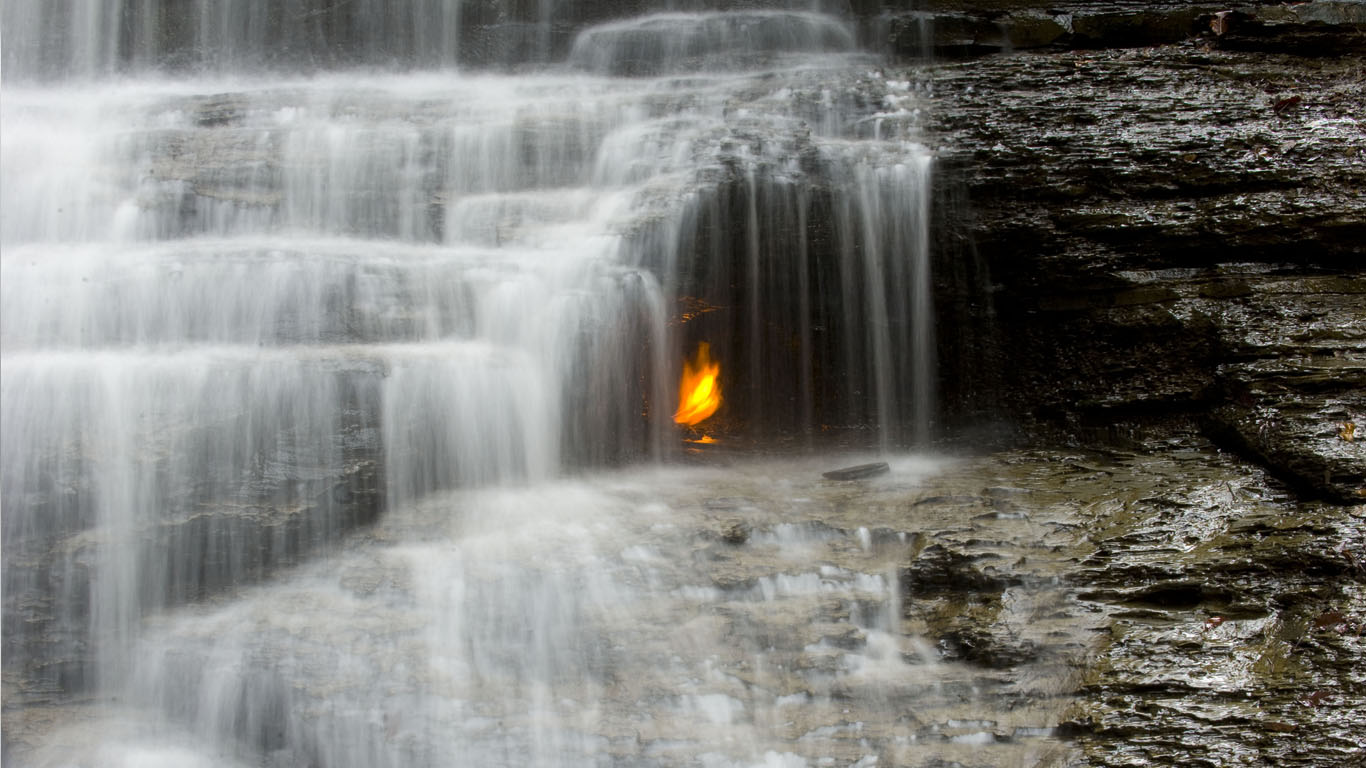
This 35-foot waterfall in Shale Creek Preserve shelters an eerie flame about eight inches high. It may appear to be a candle, but it’s actually burning gas that local legends say was lit by Native Americans thousands of years ago. Researchers have attempted unsuccessfully to find the source of the gas, and theories about its origins have been proven wrong.

Crooked Forest
> Location: Gryfino, Poland
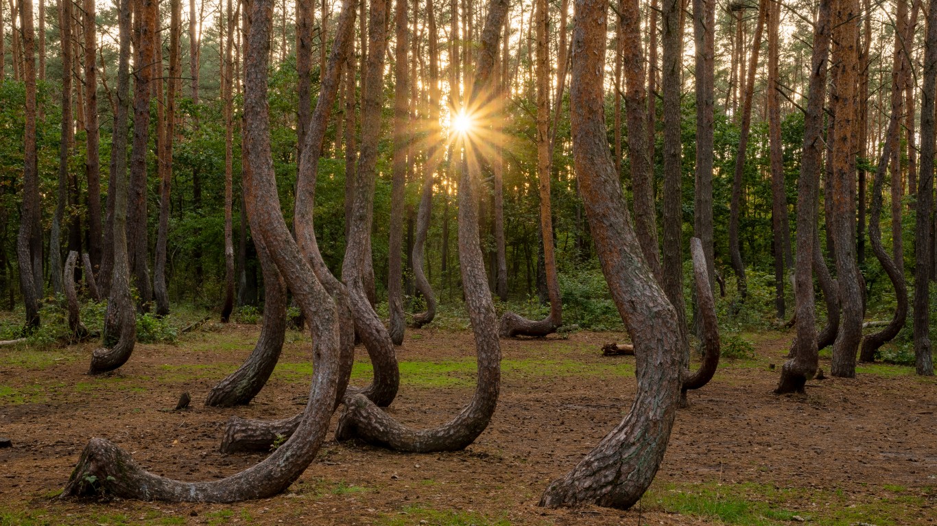
This pine forest near the town of Gryfino consists of 400 trees, planted around 1930, that have grown with bizarrely curved trunks. One plausible theory as to their shape is that they were trapped under a heavy layer of snow early in their growth. Another is that local foresters attempted to curve the trees in order to use the bent wood to make furniture. The town was mostly abandoned between World War II and the 1970s, so anyone who knew what happened to the trees is not around to tell their secret.
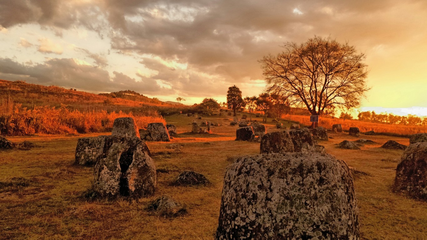
Plain of Jars
> Location: Xiangkhoang Plateau, Laos
Scattered across the Xiangkhoang Plateau are thousands of large, carved stone vessels in clusters ranging from one to 100. According to Laotian mythology, the jars were created by a race of giants after a battle victory, and were designed to brew and store rice wine. Researchers believe that the megaliths, placed here as early as 1240 B.C., were used in mortuary rituals, as cremated remains have been found within the vessels, and bones and burial goods have been excavated from areas adjacent to the jars.
[in-text-ad-2]
Stone Spheres
> Location: Palmar Sur, Costa Rica
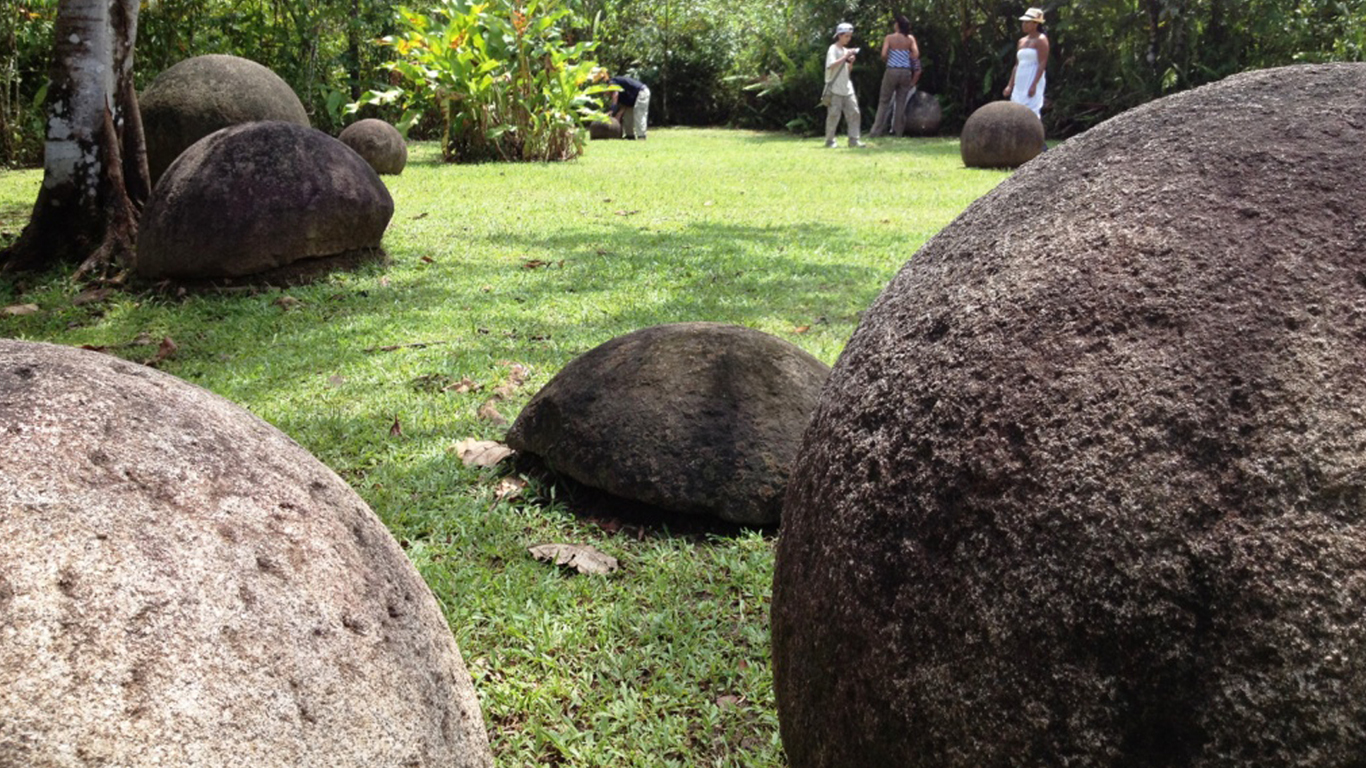
The ancient bolas de piedra, or stone spheres, found on the Diquís Delta and Caño Island of Costa Rica date back to as early as the year 600. Created by the Diquís culture, the mysterious orbs may have been used to decorate public plazas and mark the pathway to the homes of prominent governmental figures. In all, over 300 of these petrospheres dot the landscape, some over six feet in diameter and weighing up to 15 tons.
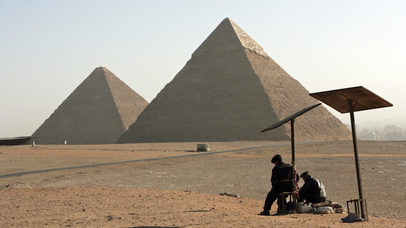
The Great Pyramid of Giza
> Location: Giza, Egypt
The oldest and largest pyramid in the complex at Giza, the Great Pyramid was built around 2,550 B.C. as a tomb for Pharaoh Khufu. The mystery of the pyramid’s construction has eluded scientists for decades. Construction of the pyramid, built of 2.3 million blocks of limestone weighing an average of 2.5 to 15 tons a piece, is thought to have utilized at least 20,000 workers and taken 20 years to complete. It was previously believed that all chambers in the Great Pyramid had been found, but in 2017, scientists detected a huge cavity over 100 feet long using particle radiography.
[in-text-ad]
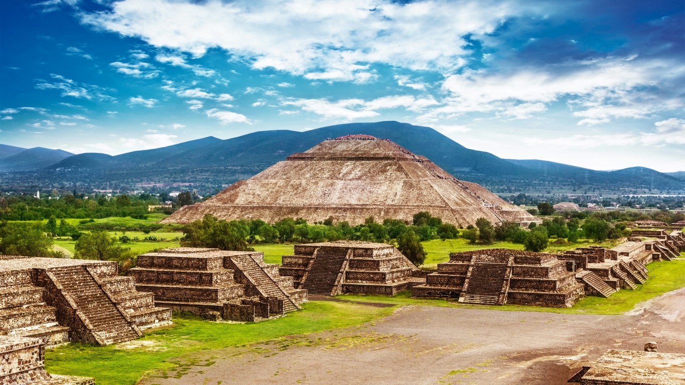
Teotihuacán
> Location: Teotihuacán, Mexico
This Pre-Aztec Mesoamerican city was first settled around 400 B.C. and reached the height of its influence around 400 A.D., when it was the most powerful city in the region with a population of 125,000. By the time the Aztecs discovered the ancient city, however, it had been in ruins for centuries. Scientists debate who its first inhabitants were and why the city was eventually abandoned. Signs of population decline and famine around the year 600 along with evidence of fires found only in structures associated with the ruling class suggest that an internal class uprising may have preceded the city’s downfall.
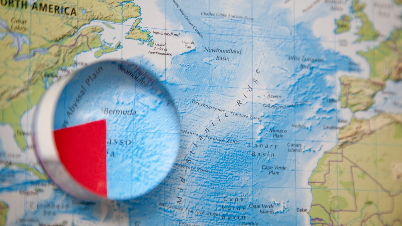
The Bermuda Triangle
> Location: Western North Atlantic Ocean
Between Miami, Bermuda, and Puerto Rico lies a putatively dangerous 500,000-square-mile stretch of ocean where numerous ships and planes are said to have mysteriously vanished. Ships lost in the triangle include the U.S.S. Cyclops, which disappeared with 309 men on board in 1918. Aircraft losses include five navy bombers that disappeared in 1945, as well as at least three commercial flights. Reportings of strange lights, explosions, and erratic compass readings accompany many of these disappearances.
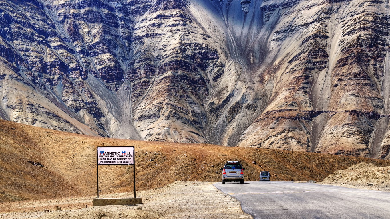
Magnetic Hill
> Location: Ladakh, India
Like another Magnetic Hill, in New Brunswick, Canada (see above), this section of roadway, surrounded by barren hills, also features an apparently gravity-defying phenomenon, where visitors can park their car in neutral and watch it roll uphill at 12 mph. Some locals claim that the hills have an anomalous magnetic force that is strong enough to move large objects, while others claim that the road leads to heaven and those who are worthy will be pulled there by divine force. A more likely explanation is that the mysterious force is actually an optical illusion caused by the topography of the area – which is also the case in New Brunswick.
[in-text-ad-2]

Roswell
> Location: Roswell, New Mexico
When an unidentified aircraft crashed into a farmer’s field in Roswell in 1947, local Air Force officials insisted that the craft was just a weather balloon. The wreckage, however, appeared to contain high-tech materials and was clearly not a weather balloon. Theories of U.F.O.s and government cover-ups have surrounded the town ever since. A government cover-up, however, may be just what happened, as declassified information released by the U.S. military in 1994 claims that the wreckage was part of a top-secret atomic weapons detection project called Project Mogul.
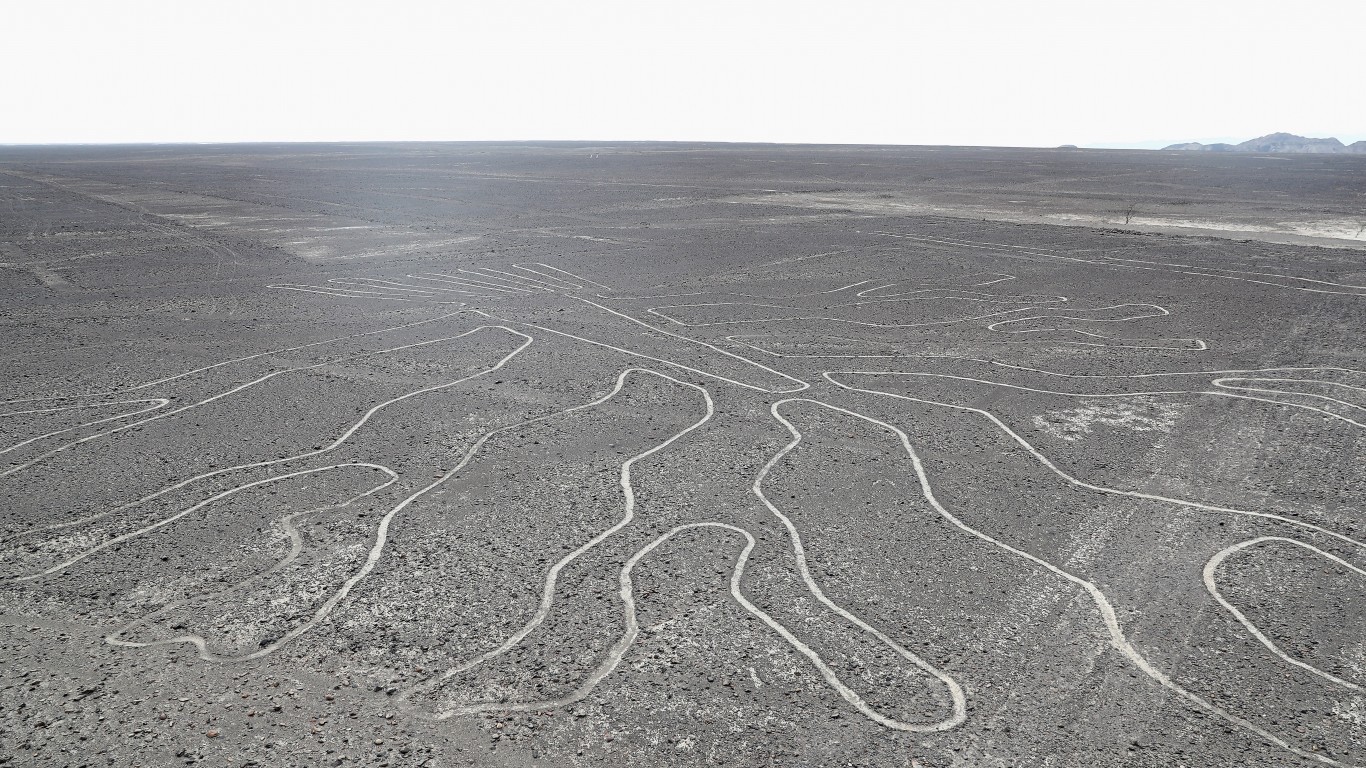
The Nazca Lines
> Location: Nazca, Peru
A series of huge geoglyphs created by the Nazca people 2,000 years ago, the Nazca
Lines have stumped researchers for years. Although they were studied prior to the 1930s, it was only with the advent of more sophisticated aircraft that their immense patterns came to light. The patterns depict over 70 animals and plants, as well as various geometric shapes, measuring up to 1,200 feet long. Some believe that they were built as a way to communicate with ancient aliens, but other theories suggest they were maps of the stars or part of a rain ritual to bring much-needed water to the arid area.
[in-text-ad]
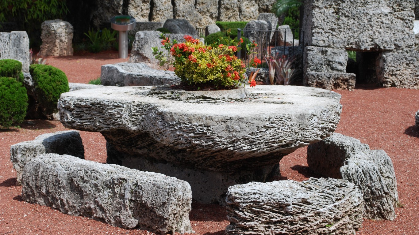
Coral Castle
> Location: Between Homestead and Leisure City, Florida
Built by Latvian immigrant Ed Leedskalnin as a monument to his former fiancée, this castle and tourist attraction is made from oolite limestone coral. Leedskalnin single-handedly quarried, transported, and assembled over 2 million pounds of coral using simple hand tools. Working under the cover of night, it took him 28 years to complete the castle. As he refused to let anyone see him work, nobody knows how he was able to move such large pieces of stone alone, and many theorists claim he used magnetism or magic to lift the massive coral blocks.
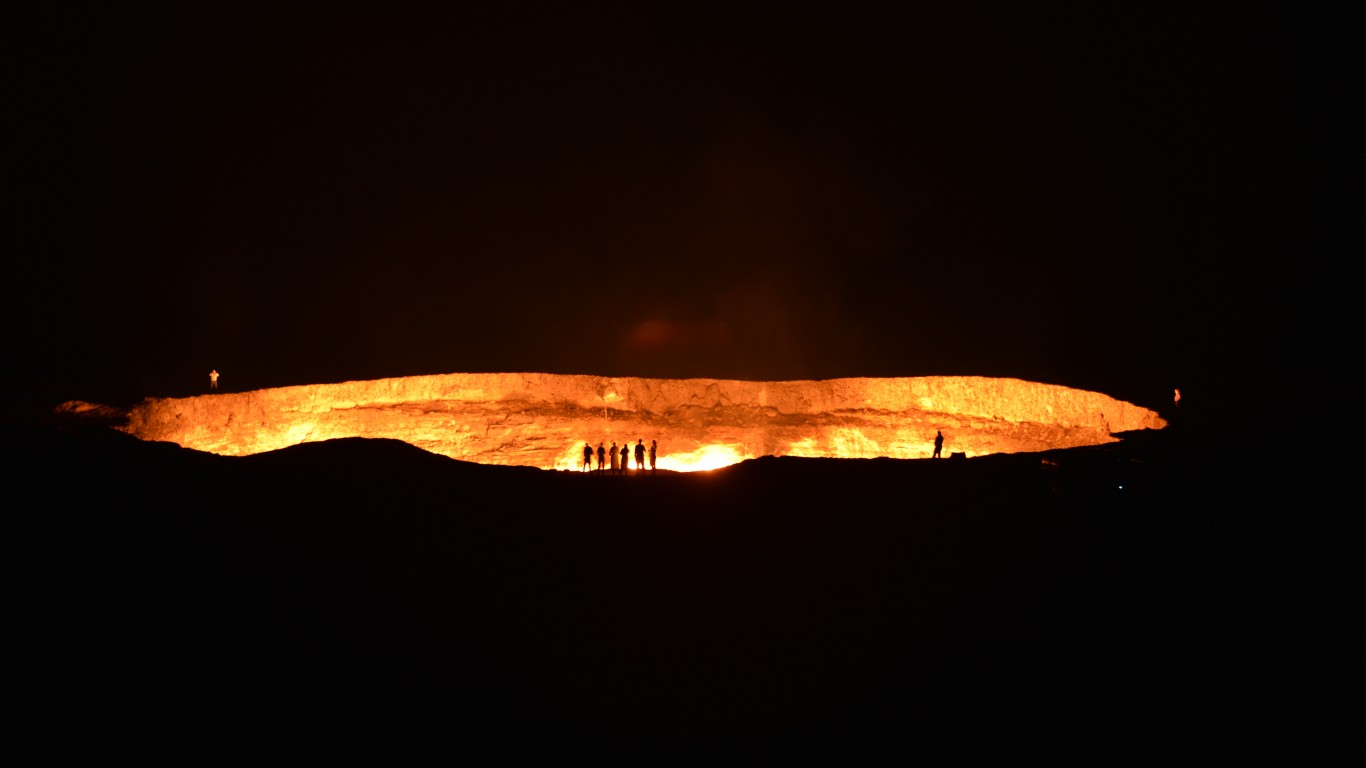
Door to Hell
> Location: Darvaza, Turkmenistan
The Darvaza gas crater, also known as the Door to Hell, is a 230-foot-wide hole in a natural gas drilling field that has been burning since 1971. The crater was formed when a Soviet drilling rig punctured a natural gas chamber and the ground collapsed under it, swallowing the rig. Fearing that poisonous gasses were being emitted, the workers lit the hole on fire – and it hasn’t stopped burning since.
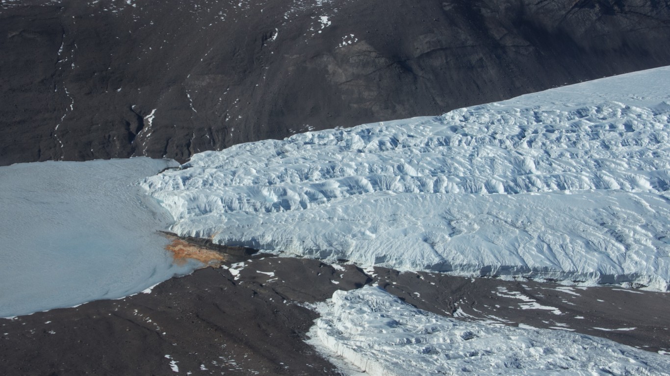
Blood Falls
> Location: Taylor Valley, Victoria Land, Antarctica
What appears to be blood staining the ice of the 34-mile long Taylor Glacier is actually the result of microorganisms. For two million years an ancient lake has been trapped under the glacier. The lake is rich in iron and inhabited by rare microbes that have evolved to digest the iron. A fissure in the glacier, discovered in 1911, allows a small amount of the ferrous lake to ooze out, creating a blood-colored waterfall that is five stories high.
[in-text-ad-2]
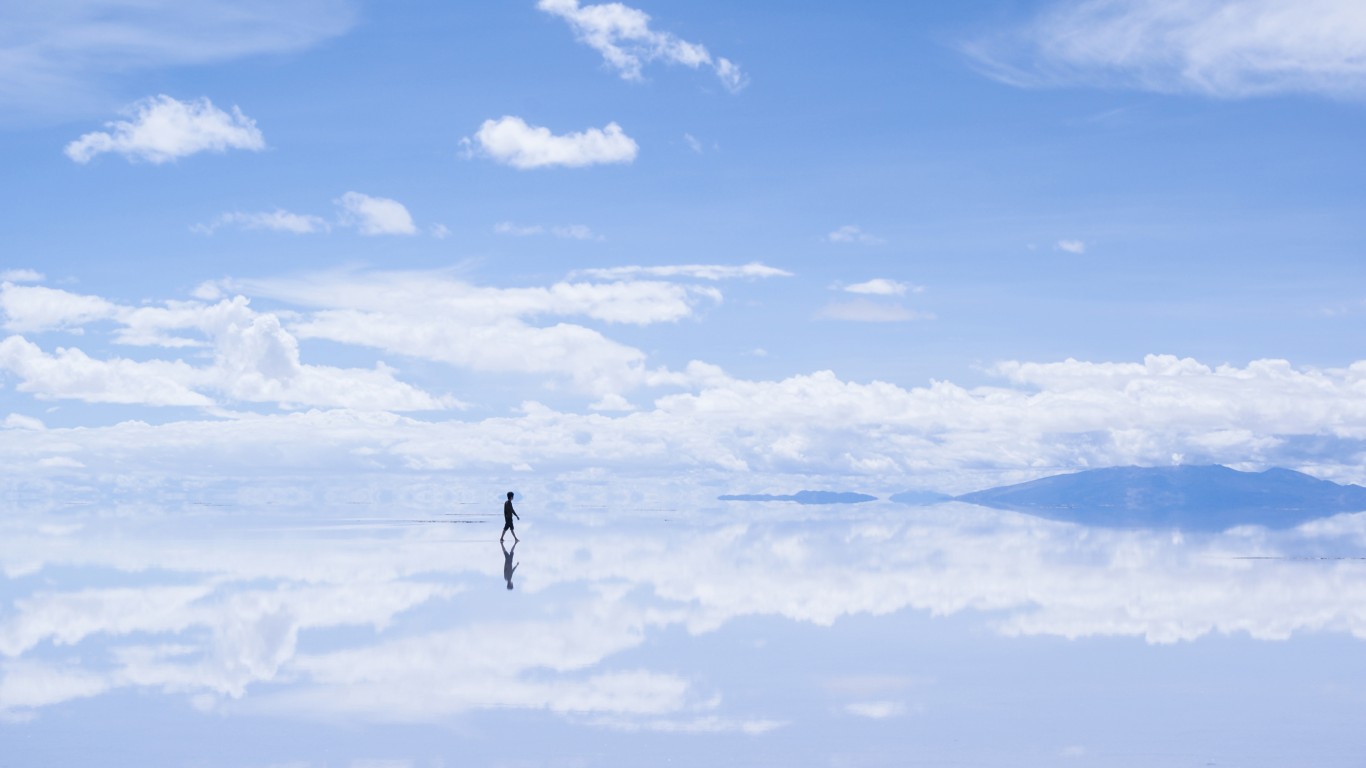
Salar de Uyuni
> Location: Daniel Campos Province, Bolivia
The largest salt flat in the world, Salar de Uyuni spans over 4,000 miles and can be bitterly cold, as it lies 12,000 feet above sea level. The site is most famous for its mirror effect during the rainy season, when it is transformed into a shallow lake that perfectly reflects the sky all the way to the horizon.
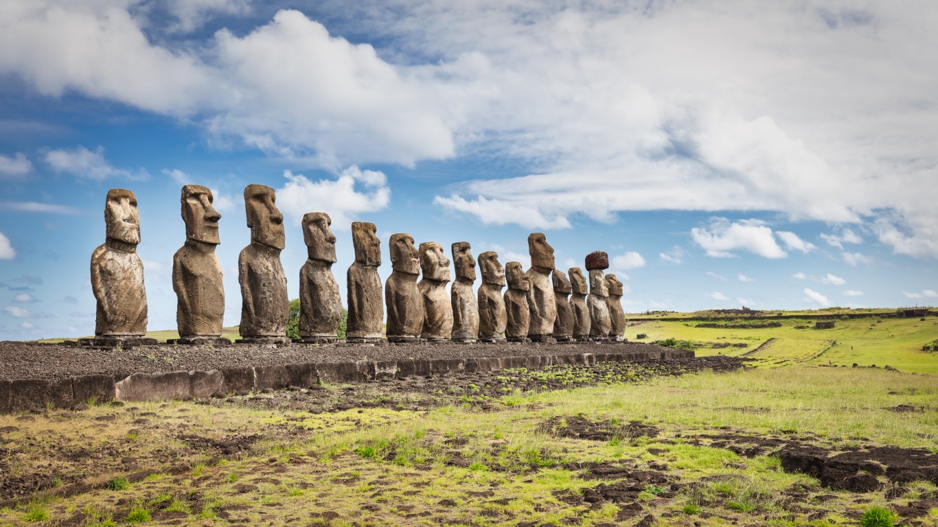
Easter Island
> Location: Southeastern Pacific Ocean (Chile)
Rapa Nui, also known as Easter Island, is a 63-square-mile volcanic island, and one of the most isolated inhabited islands on earth. It’s famous for its hundreds of ancient stone monolithic statues called Moai – commonly referred to as the Easter Island heads. The heads, in fact, have bodies that lie under years of sediment, many of them covered in petroglyphs. Possibly erected to promote agricultural fertility, the carvings can reach 33 feet high and weigh 80 tons. How the massive stones were moved into place has long been a subject of debate, but Rapa Nui oral history dictates that the statues were commanded to walk on their own.
[in-text-ad]
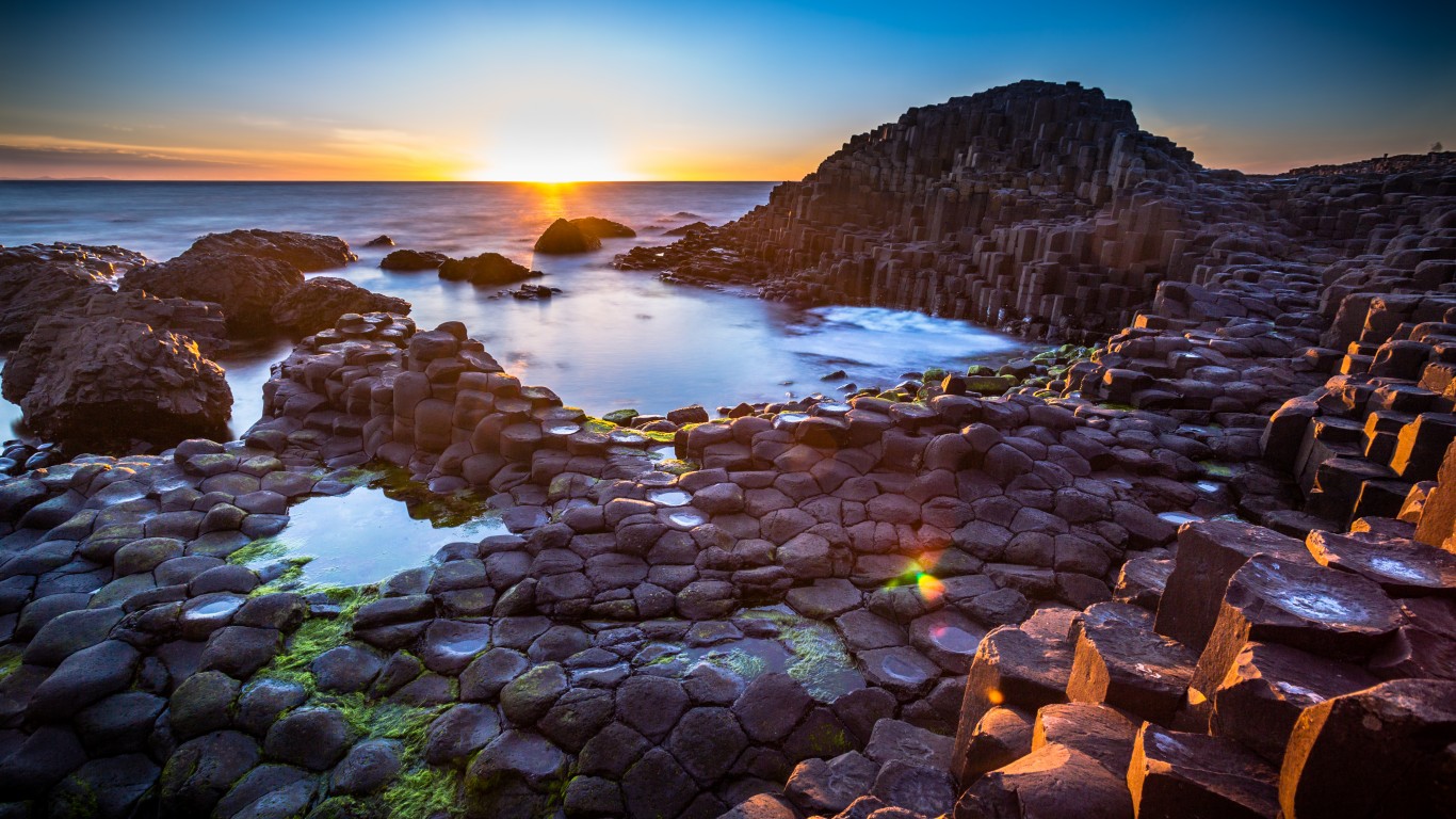
Giant’s Causeway
> Location: County Antrim, Northern Ireland
Made of a patchwork of 40,000 interlocking basalt columns, the Giant’s Causeway is a volcanic formation over 50 million years old. The site has inspired many local legends about a giant named Finn McCool, who is said to have built the causeway with stones, either while fighting with a Scottish rival across the sea or while trying to lure a lady he fancied to cross the sea and live with him in Ireland.
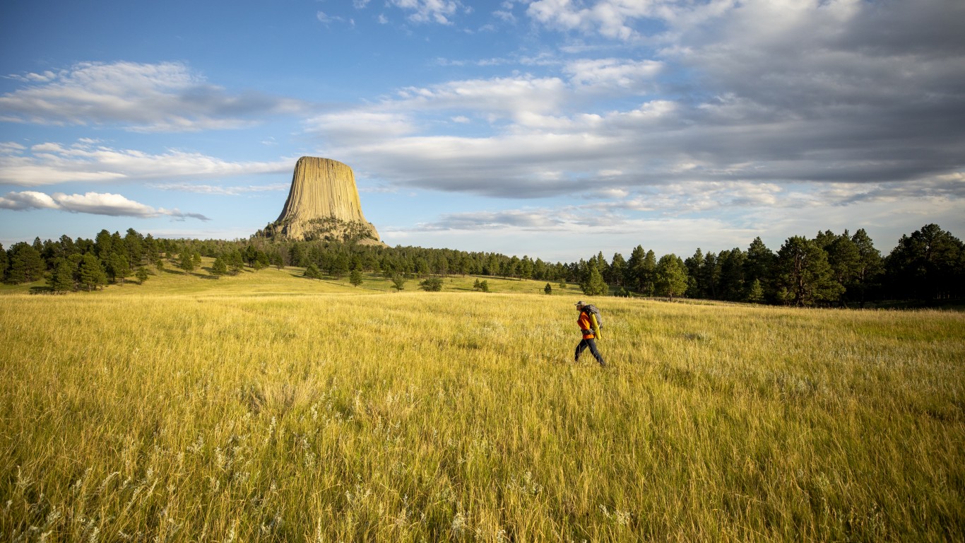
Devils Tower National Monument
> Location: Crook County, Wyoming
Misnamed through a poor translation of a Native American name during a U.S. Army expedition, this striking monument is more commonly known as Bear Lodge by local indigenous peoples. Numerous origin myths attribute its striped appearance to the claw marks of a hungry bear that chased a group of children up the steep tower. Rising 867 feet from its base, the monolith is the largest example of columnar jointing in the world. Scientists disagree about how the tower formed but know that its composition is a rare igneous rock called phonolite porphyry.
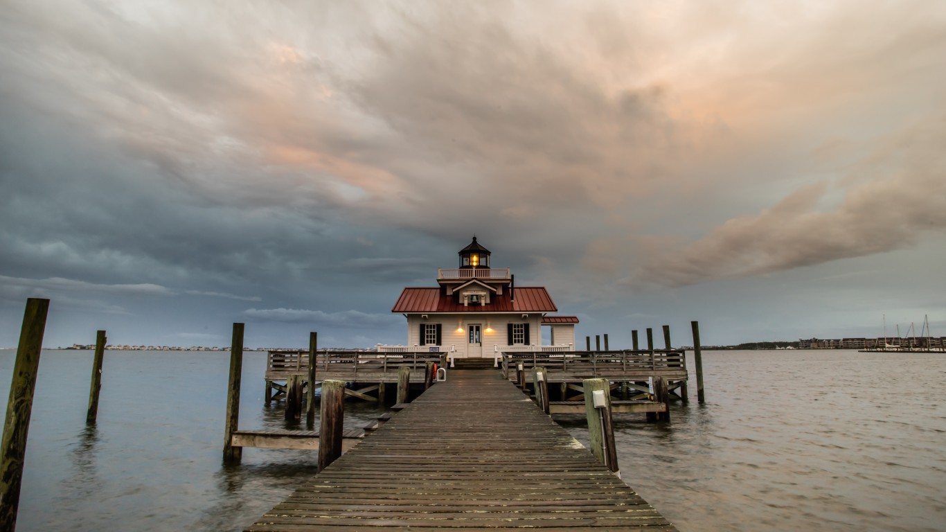
Roanoke Island
> Location: Dare County, North Carolina
Starting in 1585, colonist Walter Raleigh attempted to establish the first permanent English colony in North America. Food shortages and long supply delays plagued the Roanoke colony, and by the time a supply ship arrived – two years late – there was little trace of the 115 inhabitants. A single carved word, “Croatoan,” suggested that they may have relocated to the island of Croatoan (now Hatteras), however no sure sign of them was ever found again.
Some investigations uncovered stories that they were killed by local Native Americans or by the Spanish, while other reports suggest they were assimilated into local tribes or attempted to return to England but were shipwrecked along the way. New theories and archeological evidence continue to arise year after year, but the mystery has yet to be solved.
[in-text-ad-2]
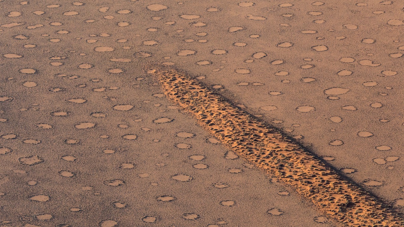
Fairy Circles
> Location: Namib Desert, Namibia
In the red sands of the Namib desert, the dry grasslands are dotted with strangely circular bare spots ranging from 10 to 65 feet in diameter, creating the appearance of a polka-dotted landscape. The formations, which are very regularly spaced, have stumped scientists for decades. A strange finding reveals that a termite colony is established under each bare spot, leading to a prevailing theory involving an interplay between plant competition for water and termite colony turf wars.
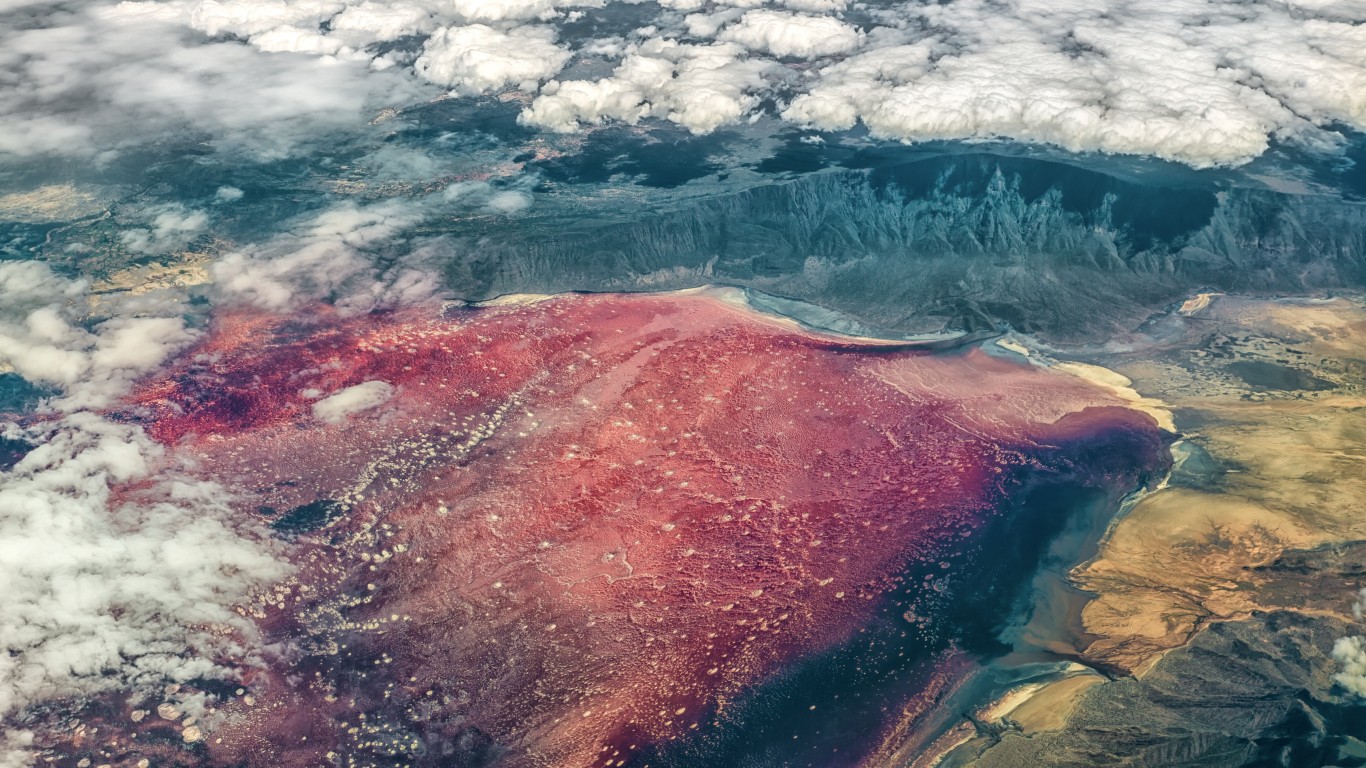
Lake Natron
> Location: Ngorongoro District, Tanzania
A seeming hell on earth, Lake Natron in Tanzania is a salt lake nearly as alkaline as ammonia, with a fiery red hue due to cyanobacteria that thrive in the hot water, which can reach 140º F. The alkaline waters corrode most objects that come into contact with them, including birds who mistakenly crash into the glass-like surface. The calcified bodies of birds and other animals can be seen washed up along the shores, resembling stone carvings.
[in-text-ad]
Pine Gap
> Location: Alice Springs, Australia
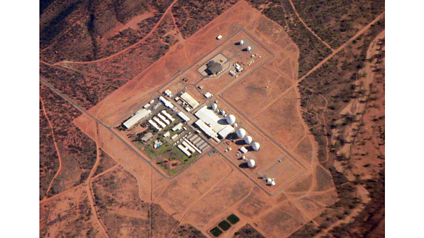
Although the Australian public was first told that Pine Gap was a space research facility, it is actually a joint U.S. and Australian surveillance base partially run by the CIA and the NSA, formed during the Cold War. Documents leaked by whistleblower Edward Snowden in 2013 first confirmed that Pine Gap was an important collection site for information used in America’s wars. It is the CIA’s most important technical intelligence collection station on earth, where satellites are used to gather information about weapons development in target countries, as well as to pinpoint airstrike targets.
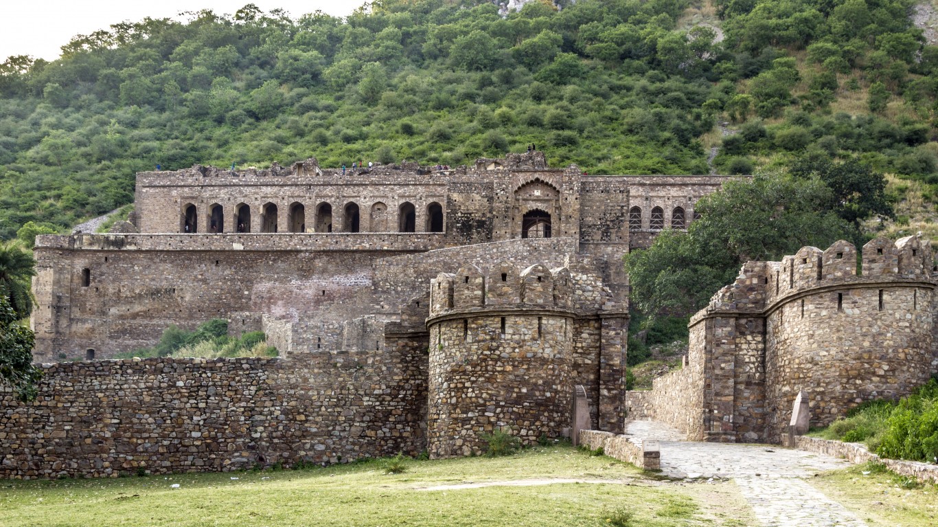
Bhangarh Fort
> Location: Alwar District, Rajasthan, India
The ruins of this 16th-century fort in Rajasthan are known as the most haunted place in India. Numerous legends tell of how it came to be haunted, including the story of a local priest of black magic who cursed the fort and its inhabitants when the princess who lived there rejected his advances. A war the next year killed most of the family, and it is said that their ghosts still haunt the grounds. Locals have other tales of hauntings to tell and insist that multiple tourists have died there in recent years as a result of strange accidents.
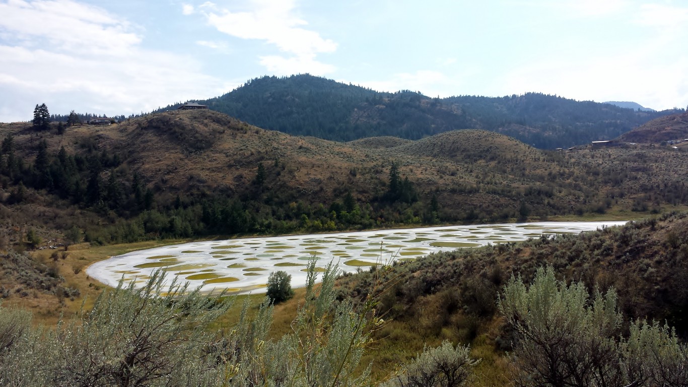
Spotted Lake
> Location: Similkameen Valley, British Columbia, Canada
In the heat of summer, this lake in British Columbia largely evaporates, leaving a polka-dotted landscape of mineral-rich pools in shades of blue, yellow, and green. The concentration of various salts and minerals dictate the color of each pool. The lake has long been sacred to the people of the Okanagan Nation, who believed that each spot possessed different healing properties.
[in-text-ad-2]
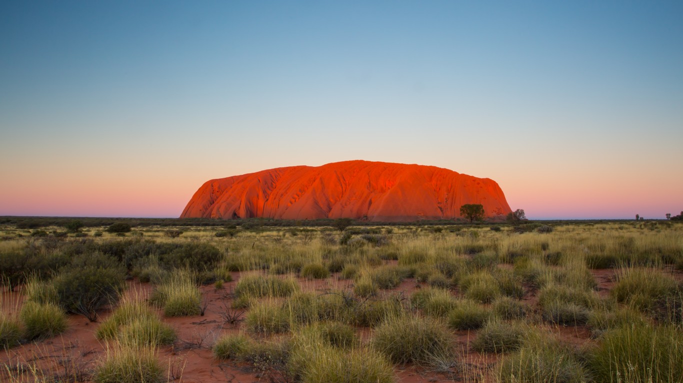
Uluru
> Location: Uluru-Kata Tjuta National Park, Australia
This massive, isolated sandstone monolith, also known as Ayers Rock, is famous for its bright red hue. It rises 1,142 feet from the surrounding desert and is nearly six miles in circumference. Uluru is a sacred site to the Anangu Aboriginal people of the area, whose mythology dictates that the mound was created by ancestral beings during the Dreamtime. Caves within the base of the stone contain ancient petroglyphs dating back 5,000 years.
Travel Cards Are Getting Too Good To Ignore (sponsored)
Credit card companies are pulling out all the stops, with the issuers are offering insane travel rewards and perks.
We’re talking huge sign-up bonuses, points on every purchase, and benefits like lounge access, travel credits, and free hotel nights. For travelers, these rewards can add up to thousands of dollars in flights, upgrades, and luxury experiences every year.
It’s like getting paid to travel — and it’s available to qualified borrowers who know where to look.
We’ve rounded up some of the best travel credit cards on the market. Click here to see the list. Don’t miss these offers — they won’t be this good forever.
Thank you for reading! Have some feedback for us?
Contact the 24/7 Wall St. editorial team.
 24/7 Wall St.
 24/7 Wall St.
 24/7 Wall St.
 24/7 Wall St.
